Humpback Mountain Property Protected on Blue Ridge Parkway – Marks 50th Parkway Property Conserved

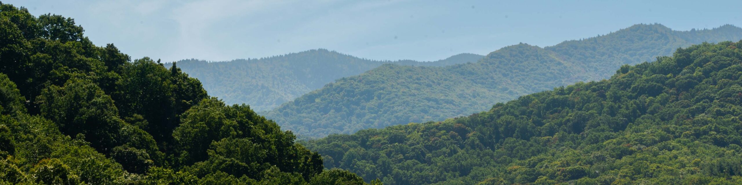
Conservation Trust for North Carolina (CTNC) purchased a spectacular 523-acre property on Humpback Mountain in Avery and McDowell counties. The tract borders the Blue Ridge Parkway for nearly 3.5 miles between mileposts 319 and 323.

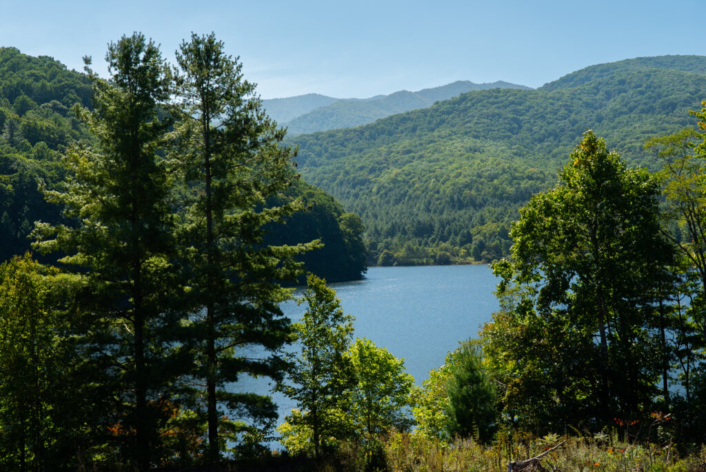
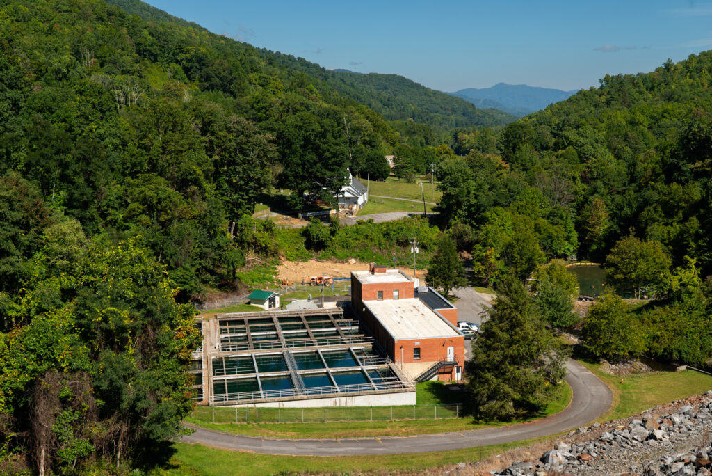
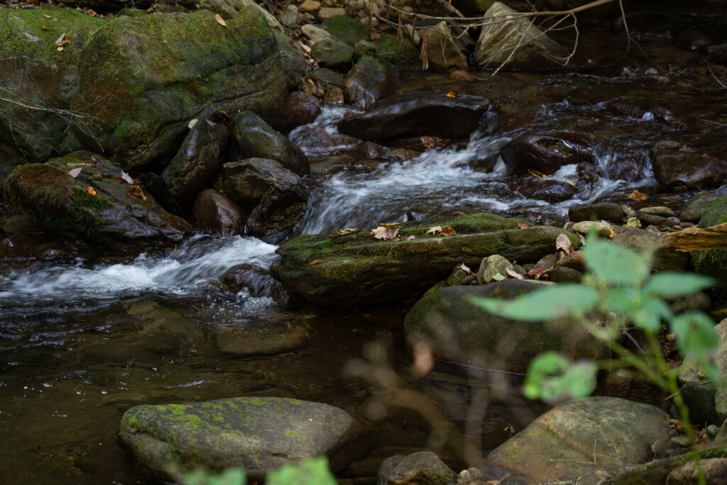
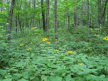
The Humpback Mountain property contains over three miles of clear-running streams. These tributaries of both the North Toe River and the North Fork Catawba River will remain pristine for wild trout populations and for drinking water supplies for downstream communities. Preservation of the property will also maintain healthy forests and wildlife habitat and will prevent any changes to a potentially developable ridge top bordering the Parkway.

The Conservation Trust purchased the tract with generous funding from Fred and Alice Stanback of Salisbury, the NC Clean Water Management Trust Fund, and the National Fish and Wildlife Foundation’s Acres for America Program.

“Conserving the Humpback Mountain tract is essential to preserving scenic views that draw millions of people to the Blue Ridge Parkway each year,” said Mark Woods, Blue Ridge Parkway Superintendent.  “We congratulate the Conservation Trust for North Carolina for protecting its fiftieth property along the Parkway.”

“Permanent protection of the Humpback Mountain property will ensure clean water downstream, contribute to a growing conserved area for habitat, and increase recreational opportunities for North Carolina families,” said Margaret Newbold, CTNC Associate Director.

Preservation of this property expands the existing wildlife corridor linking neighboring state and federally owned properties, increasing the capacity to support healthy animal populations. The tract is adjacent to CTNC’s Little Tablerock Mountain project, which CTNC protected in 2004 and subsequently conveyed to the NC Wildlife Resources Commission (WRC) for inclusion in its Game Lands program. The Conservation Trust will convey the Humpback Mountain property to WRC as well, expanding public access to conserved lands.

Protection of Humpback Mountain continues CTNC’s broader efforts, in close cooperation with local land trusts and government agencies, to protect the highest priority scenic views, streams, and forests along the Parkway. CTNC’s efforts are guided by a sophisticated GIS-based conservation plan and mapping tool to ensure that limited resources are focused on the most critical lands to conserve.

Highlights among CTNC’s 50 Parkway projects include Asheville’s 17,000-acre drinking water supply watershed, Waynesville’s 8,000-acre watershed, and a 1,500-acre property bordering the Orchard at Altapass near Spruce Pine.

Property Conserved on Bear Creek at Blue Ridge Parkway

The Conservation Trust for North Carolina (CTNC) recently purchased a property that adjoins the Mountains-to-Sea Trail and the Blue Ridge Parkway near milepost 446.  The tract contains a portion of Bear Creek in the headwaters of North Fork Scott Creek in Jackson County. 

The property is completely forested and contains a beautiful cascading section of Bear Creek.  Protection of the property will preserve views from the Mountains-to-Sea Trail and the Blue Ridge Parkway (including the Woodfin Cascades Overlook) and will provide a natural buffer to the Hi-Mountain subdivision.  The property contains a portion of the Woodfin Falls Significant Natural Heritage Area and is in close proximity to the 6,000+-acre complex of lands within the proposed Waterrock Knob/Plott-Balsams Park along the Blue Ridge Parkway.

“Safeguarding these 31 acres of sensitive high elevation habitat is another impressive CTNC accomplishment,” said Monika Mayr, Acting Superintendent of the Blue Ridge Parkway.  “Each time buffer land is added to the Blue Ridge Parkway corridor, we assure millions of visitors will continue to enjoy a spectacular, unspoiled landscape.  This acquisition is essential not only to protect the views but to connect wildlife habitat and critical natural ecosystems for local populations of black bear, white-tailed deer, Rocky Mountain elk, and northern flying squirrels.”

“This tract is near a particularly beautiful section of the Mountains-to-Sea Trail, so we are delighted that CTNC has acquired it to protect the views forever,” said Kate Dixon, Executive Director of Friends of the Mountains-to-Sea Trail.

CTNC purchased the property on May 23, 2013, for $215,000 from Greer State Bank in South Carolina with the intention of conveying the property to the National Park Service for inclusion in the Blue Ridge Parkway’s official boundary. David McCammon, a representative of Greer State Bank stated, “We appreciate CTNC’s goals and objectives. In most cases, land we sell is almost immediately modified in some way. We are glad to be able to further CTNC’s efforts for preservation. I spend a good bit of time outdoors, particularly in western NC and upstate SC, so nature preservation is an important personal goal as well.”

Southern Appalachian Highlands Conservancy (http://www.appalachian.org/), a local land trust based in Asheville, also works to conserve land along the Blue Ridge Parkway in Jackson County.

Asheville Watershed Protected – Again!

CTNC and the Asheville City Council have come to a final agreement on a new conservation easement that strengthens protections for the city’s drinking water supply watershed. Recorded on January 28, the “new and improved” easement replaces one that had been in effect since 1996. (The easement is a permanent legal agreement that restricts activities on the property that could degrade water quality, forest health, wildlife habitat, or scenic views from the Blue Ridge Parkway).

Asheville’s North Fork Reservoir and Bee Tree Reservoir are fed by creeks and streams trickling down more than 17,000 forested acres in the Black Mountains.

The Asheville City Council had unanimously approved a new draft easement on December 11, 2012, and the parties worked diligently since then to complete a final document. CTNC will hold the easement, and the Southern Appalachian Highlands Conservancy (SAHC), the local land trust based in Asheville, will serve as the “backup holder” should that become necessary.

The easement’s top priority is to care for the land to ensure high water quality in the streams and reservoirs.  A key new provision is that commercial logging is prohibited on the property.  The agreement calls for a forest stewardship plan to guide activities that will maintain forest health and wildlife habitat.  And, the easement ensures that spectacular views of the watershed along fifteen miles of the Blue Ridge Parkway will remain unspoiled. 

The agreement was reached amid the backdrop of great controversy and uncertainty regarding future ownership and management of Asheville’s water system.  Members of the General Assembly are writing a bill that would transfer authority from the city to the Metropolitan Sewerage District.  The fate of that legislation remains to be determined.

“The new agreement guarantees that no matter who is in charge of Asheville’s water supply in the future, stronger protections for water quality, forest health, wildlife habitat, and scenic views will be locked into place forever,” said Reid Wilson, CTNC executive director.

The Southern Appalachian Highlands Conservancy was a crucial partner throughout the redrafting of the agreement. “When the original easement was put into place in 1996, it was state-of-the-art. However, in the years since then, we’ve learned a great deal about how to strengthen such agreements so that they withstand the test of time. It was wise for the parties to take action to strengthen the protections for the watershed,” said Carl Silverstein, SAHC executive director.

“It was nearly 100 years ago that Asheville’s leaders began acquiring lands in the watershed,” said Marc Hunt, a member of the Asheville City Council. “They knew that protecting the land that feeds the water supply was critical to public health and economic growth.  Approval of stronger permanent protections will build on that legacy and will ensure safe and plentiful drinking water for generations to come.”

CTNC Protects Blue Ridge Parkway Vista, Historic Trail

CTNC recently purchased a property that contains an important portion of the Overmountain Victory National Historic Trail (OVT) near Spruce Pine and the Orchard at Altapass, and which is highly visible from the Blue Ridge Parkway.

The 128-acre property in McDowell County is located at the Heffner Gap Overlook (Parkway milepost 326) and is visible from both the Heffner Gap and Bear Den overlooks. The tract lies between two other properties that CTNC previously protected: the 1,488-acre CSX conservation easement and the 534-acre Rose Creek/OVT Natural Area, which is now managed by the North Carolina Wildlife Resources Commission as a state game land.

The tract contains a short but critical section of the OVT that links nearly 1.6 miles of the Trail on the CSX easement with a 1.3-mile section on the Rose Creek property. The OVT traces the route taken by colonial militia to the pivotal battle of Kings Mountain during the American Revolution.

National Park Service (NPS) Overmountain Victory National Historic Trail Superintendent Paul Carson said, “CTNC’s protection of this property will open up a new section of the trail for public use and we look forward to working with CTNC and the Blue Ridge Parkway to extend the trail for public enjoyment. It is especially exciting because so much of the surrounding landscape and views from the trail will remain as they were at the time the patriots traveled this route.”

Blue Ridge Parkway Superintendent Phil Francis added, “Stunning views from the Heffner Gap and Bear Den Overlooks will remain unspoiled because this property was conserved. It’s especially important since the tract is so close to the Parkway boundary.”

“Protecting this property will provide multiple benefits for generations to come,” said Reid Wilson, CTNC executive director. “Beautiful views from two Parkway overlooks are preserved, a portion of the Overmountain Victory Trail will connect two longer sections on either side for hikers, and the forest and wildlife habitat will remain healthy.”

CTNC purchased the property on December 21, 2012, for $700,000 from John & Anna Watson of Atlanta, GA with a $544,000 grant from the NC Department of Transportation’s Scenic Byways Program as well as funds from the NC Environmental Enhancement Grants Program and Fred & Alice Stanback of Salisbury.

CTNC anticipates transferring the property to the National Park Service to be incorporated within the official boundaries of the Blue Ridge Parkway unit and dedicated as an official section of the NPS Overmountain Victory National Historic Trail. The OVT will soon be open on the Heffner Gap tract.

Parkway Land Exchange with Blowing Rock Completed at Last!

After 11 years, the National Park Service (NPS) and the Town of Blowing Rock have completed an important land exchange that adds 192 pristine forested acres to the Parkway’s official boundary. In return, Blowing Rock received from NPS a 20-acre property that contains the town’s drinking water reservoir.

In 2001, CTNC kicked off the process by purchasing the 192-acre Johns River Gorge property before a developer could implement plans to build homes there. The tract, adjacent to Moses Cone Park and US Forest Service lands, contains healthy forests and wildlife habitat, and a beautiful hiking trail along the pristine waters of China Creek. (The trail will be available for public use).

The town of Blowing Rock and CTNC worked together to secure a grant from the NC Clean Water Management Trust Fund so that the town could purchase the property from CTNC in 2003. Since then, NPS and Blowing Rock have been working together to trade the properties. Federal land exchanges require congressional approval, and in 2010 President Obama signed into law the bill that both houses passed.

This is a huge win for the forest, creek, and trails. Thank you to all of you who communicated with your congressional offices and/or submitted supportive comments to the National Park Service.

Asheville Council Votes to Strengthen Watershed Protections

On December 11, 2012, the Asheville City Council voted unanimously to strengthen the conservation easement that covers the city’s 17,000-acre watershed in the Black Mountains. This is an important step towards providing stronger permanent protections for the forested mountains and two reservoirs that comprise the watershed.

Since 1996, CTNC has held a conservation easement on the property to safeguard its spectacular conservation values. That easement was excellent for 1996, but we’ve learned a lot since then about how to ensure better land protection. That’s why over the last several months the city, CTNC, and the Southern Appalachian Highlands Conservancy (SAHC) have worked together to strengthen the agreement. The new draft easement strengthens permanent protections for drinking water quality, forest health, wildlife habitat, and scenic views along fifteen miles of the Blue Ridge Parkway. Among other things, the draft easement prohibits any commercial logging, ever, on the property.

The Asheville City Council (particularly Marc Hunt) deserves a great deal of credit for taking this positive action. We still have some I’s to dot and T’s to cross, but within a few weeks, we hope to have a brand new conservation easement approved by both the city and CTNC’s board of directors. We’ll keep you posted.

Making a home… and protecting it

CTNC honarary board member Eric Montross developed love for his adopted home state

From time to time we invite a CTNC supporter to write a note to our friends to explain why the work of North Carolina’s land trusts is so important to them. Here’s one from Eric Montross, a member of CTNC’s honorary board of directors.

Eric Montross and famiily

All of us are drawn to specific places that embody North Carolina’s natural beauty. Whether it’s the coast, the Piedmont or the mountains, something has triggered a deep appreciation in us towards this great state. Only through the preservation of these natural wonders – rivers, forests, farms, wetlands and vistas – can we be certain that others will be able to develop the same emotional bonds we have.

My love for this state began in the fall of 1990 as a freshman student athlete at the University of North Carolina. Although I was recruited to play basketball, it wasn’t long before trips home with my roommates who lived in Shelby, Angier and Mocksville exposed me to the state’s natural treasures. As we traversed the countryside in search of flounder, red drum, trout streams and bass ponds, I began to take in the natural beauty of this state, a place my family and I would eventually call home. Yes, there was something intoxicating about the splendor of this land and its people, and my wife, Laura, and I wanted to make sure our children were able to experience this richness.

As the years have passed, I have become vitally aware of the need to preserve the natural resources and physical beauty of our state, and to take a more active role in its preservation. The Conservation Trust for North Carolina acts as an informed liaison for landowners who also believe they can play a critical role in the preservation of the state’s land and water. CTNC’s board and staff are a trusted team who seek out opportunities to assist in conservation decisions that benefit landowners and future generations.

CTNC is like no other organization that works to protect our land and water. As a land trust, CTNC has safeguarded more than 30,000 acres of natural wonders along the Blue Ridge Parkway. And as a champion for the 23 local land trusts across the state, CTNC provides essential funding, advocacy and outreach so that those groups can conserve more land in the communities they serve.

Most of us have an innate desire to protect the places we love, but we don’t know how to make this wish a reality. By financially supporting CTNC, you can promote the well being of our state and ensure that future generations have the chance to see, hear and feel the magical touch of North Carolina from its coastal waters to its mountain landscape.

Thank you for joining me in helping preserve this place we love.

Sincerely,

Eric Montross

Eric Montross

Expanding the Parkway ribbon

CTNC donates more Blue Ridge Parkway property to NPS

The Blue Ridge Parkway just got a little bit wider: We donated a small but critical tract of protected land near Cumberland Knob to the National Park Service.

CTNC bought the Roaring Fork Headwaters II property with the intention of giving it to the park service for inclusion in the Parkway corridor.

In times when government has limited resources to protect critical land and water resources, the work of local conservation groups like CTNC is essential to our ability to safeguard the special charm of the Blue Ridge Parkway corridor,” said Phil Francis, Parkway superintendent.

CTNC purchased the 12.7-acre tract near Milepost 220.6 in August 2011 and transferred it to the National Park Service (NPS) early this month. It joins two more properties in the area that were also protected by CTNC and donated to NPS:

  • Saddle Mountain Vista, a 201-acre property acquired by CTNC in 2004 with help from the N.C. Clean Water Management Trust Fund and donated to the NPS in 2007.
  • Roaring Fork Headwaters I, a 49-acre tract purchased by CTNC in 2009 and donated to the NPS in 2010.

All three properties are highly visible from several Parkway vantage points including the Fox Hunters Paradise Overlook in the Cumberland Knob National Recreation Area. They all contain headwater streams of Roaring Fork, a tributary of the Fisher River, and headwaters of the Yadkin River, which provides drinking water for a million people in the North Carolina Piedmont, including residents of Winston-Salem.

The three properties are part of a growing landscape of protected land in the area. They lie north of the 3,400-acre Saddle Mountain Wilderness area and south of the 1,000-acre Cumberland Knob National Recreation Area.

Financial support for the purchase of Roaring Fork Headwaters II was provided by the Cannon Foundation, the John and Anna Hanes Foundation, the Tom and Elaine Wright Family Fund, the Park Foundation, other private donors, and the N.C. Environmental Enhancement Grants Program.

CTNC Donates Land for City Park

Undeveloped property will be urban oasis for Asheville

An eight-acre sanctuary of wooded beauty near downtown Asheville will be permanently protected from development thanks to a donation from CTNC.

We transferred the Falconhurst Natural Area to the city of Asheville this month in an agreement that will bar development of the site while allowing some improvements for public use, such as unpaved hiking trails and footbridges across tributaries to Smith Mill Creek on the tract’s eastern edge.

The property is named for the Falconhurst neighborhood in which it lies. It is a rare, unspoiled area of rolling hills and trees off busy Patton Avenue, just two miles west of downtown, and is adjacent to a city-owned property that will provide access. The undeveloped property has long been the focus of nearby residents’ efforts to preserve it in an unspoiled state and make it available for public enjoyment.

“The donation of the Falconhurst property is a great opportunity and example of partnership between CTNC and the city to preserve a significant natural area in West Asheville,” said Asheville Mayor Terry M. Bellamy. “I believe the property is an exceptional addition to our city and will become a popular attraction for area residents.”

The property was donated to CTNC in 1996 by Buncombe County. CTNC protected it from development, though it has not been open to the public. The Asheville City Council voted March 26, 2009, to accept the property from CTNC. In partnership with CTNC, the Southern Appalachian Highlands Conservancy, Asheville’s local land trust, will conduct annual monitoring of the property to ensure compliance with the deed restrictions.

“When we talk about conserving our natural treasures, most people think about huge parks, forests or rolling farmland,” said Reid Wilson, CTNC executive director. “Many city residents and their families love those places, but don’t have easy access to them. Increasingly, land trusts are helping to build healthy communities by protecting small pocket parks, such as this one, that are easy for all citizens to enjoy.”

Clean Water – From Land to Your Glass

Waynesville watershed is model for connecting natural land to drinking water quality

Lee Galloway knew what still needed to be done to protect his town’s drinking water supply.

Galloway, the Town Manager for Waynesville, a mountain town of about 10,000 people in Haywood County, had to figure out how to conserve the last big chunk of land that contains hundreds of creeks feeding the town’s reservoir. The 50-acre lake sits at the bottom of a bowl of towering, forested mountains. Galloway knew that every drop of rain that hit those mountainsides could reach the lake – his town’s drinking water supply.

Arial view of the Waynesville Watershed.

More than a century ago, Waynesville’s leaders began buying properties within this watershed to ensure safe drinking water for the town’s residents. Their forward-thinking actions set a precedent. Most of the land in the watershed was bought during the first half of the 20th century, but a large section still remained in private hands. The problem for Galloway, however, was that this sizeable unprotected tract lay within the larger preserved area.

The Waynesville watershed comprises 8,030 acres of forest land, about the size of the Biltmore Estate to the north near Asheville. The fast-running headwaters that gurgle down every incline toward the reservoir are clear and cold. The trees are huge and wildlife is plentiful; the area contains two State-designated Natural Areas that house unique plant and animal communities. And the property provides breathtaking scenery along nearly 10 miles of the Blue Ridge Parkway.

To ensure the permanent protection of this amazing natural resource, Galloway turned to several organizations he thought could help. He talked with the Conservation Trust for North Carolina (CTNC)Southern Appalachian Highlands Conservancy (SAHC)Mainspring Conservation Trust, the NC Land and Water Fund, and Western Carolina University. The groups hatched a plan to provide stronger safeguards for the entire watershed, including the acquisition of a 691-acre privately owned tract within the watershed.

“We wanted to protect public health by keeping our drinking water supplies as clean as possible. At the same time, we wanted to support the local tourism economy by preserving the stunning views from the Blue Ridge Parkway,” Galloway says. “We came up with an agreement that enabled Waynesville to grow while still protecting the area’s ecological diversity, scenic views and primary source of clean, safe drinking water.”

During a sometimes arduous process, the project partners’ persistence and creativity enabled them to overcome numerous hurdles along the way to protecting  the watershed.  They secured grant funding from the State Division of Water Quality, NC Land and Water Fund, and the U.S. Environmental Protection Agency. They reviewed and revised dozens of drafts of two conservation agreements (easements) that addressed different areas within the watershed.  The Town of Waynesville’s Board of Aldermen held public hearings and voted to approve the easements.

In 2005, after eight years of hard work by the partners, the Waynesville Watershed was permanently protected. Today, the Town owns all 8,030 acres. CTNC and SAHC jointly hold and manage a conservation agreement on 7,339 acres and the NC Land and Water Fund holds an easement on the 691-acre tract. Land trust staff visit the watershed every year to ensure the easements’ terms are being upheld. Shortly after consummation of the deal, the partners prepared a comprehensive biological inventory and forest management plan. Limited forest management is allowed on the larger tract, guided by the plan, while the smaller property is held under a “forever wild” easement. Public access is allowed from time to time on town-guided educational tours.

“We know that it’s far more cost-effective to keep drinking water supplies clean by safeguarding land within the watershed, rather than cleaning up polluted waters entering our reservoir,” Galloway said. “This project is a great example of public and private partners working together – persistently and cooperatively – to overcome obstacles and leverage their resources for the good of our citizens.”

Thanks to long-standing efforts to protect the streams and underground springs that feed the reservoir, the Waynesville Watershed has earned the highest quality ranking the state can assign a drinking water source. The forested, undeveloped land is also able to efficiently trap rainfall to gradually fill the reservoir, meaning the town’s water supply is particularly resilient to extended droughts as well as intense heavy rain events.

This partnership is a model for what can be accomplished when land trusts, landowners, government agencies, and academic institutions join forces to build community resilience through the power of conservation solutions.

Categories