The Upper Neuse Clean Water Initiative, a coalition of nonprofit conservation organizations, has released its 2015-2045 Conservation Strategy, which demonstrates the value of land conservation as a key investment to protect drinking water supplies in North Carolina’s Upper Neuse River Basin. The Conservation Strategy identifies the most important areas to conserve to ensure water quality downstream and sets an ambitious goal of preserving 30,000 acres over the next 30 years.
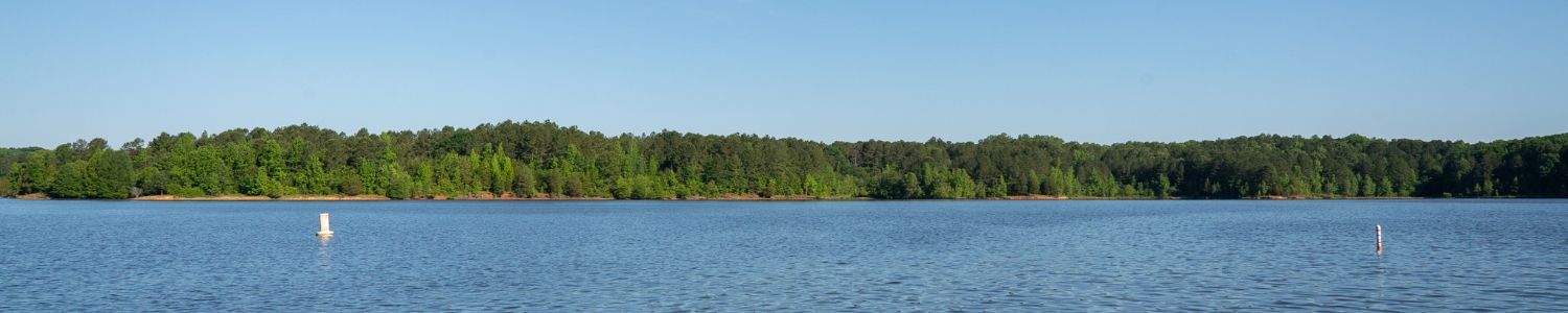
The Conservation Strategy serves as an update to the Upper Neuse Clean Water Initiative’s original 2006 plan, through which the initiative has already protected 90 properties, 84 miles of stream banks, and 7,698 acres in the Upper Neuse River Basin. The basin is home to nine drinking water reservoirs that provide drinking water to over half a million people in Raleigh, Durham, Butner, Creedmoor, Garner, Hillsborough, Knightdale, Rolesville, Stem, Wake Forest, Wendell, and Zebulon.
The Upper Neuse Clean Water Initiative is coordinated by the Conservation Trust for North Carolina and includes Ellerbe Creek Watershed Association, Eno River Association, Tar River Land Conservancy, The Conservation Fund, Triangle Greenways Council, Triangle Land Conservancy, local governments, and state agencies. Together with willing landowners, the partners are protecting critical natural areas to ensure the long-term health of drinking water in the Upper Neuse River Basin.
 The initiative’s efforts, including land acquisition, landowner outreach, monitoring, and stewardship, have been funded by the city of Raleigh Public Utilities Department through its Watershed Protection Fund. Revenue is generated from a fee of $0.15 per 1000 gallons of water used by Raleigh’s water utility customers, averaging about 60 cents a month per household and generating more than $2 million a year for water quality protection. Significant additional financial support from local governments in the basin, including Durham, Granville, Orange, and Wake Counties, and the cities of Durham and Creedmoor, and the state’s Clean Water Management Trust Fund, has been critical to the initiative’s success.
The initiative’s updated planning process produced an enhanced GIS-based Watershed Protection Model, which uses the best available science and geographic data to map the most important areas for land conservation, based on four main goals: protecting water sources, preserving upland forests and farms, protecting wetlands and floodplains, and protecting vulnerable areas with steep slopes and wet soils. The Raleigh Public Utilities Department briefed Raleigh City Council on the new conservation plan at its April 19 work session, and the land trust partners will be briefing local governments upstream in the coming months.
“By pinpointing forests and other natural areas that provide the most bang for the buck for water quality protection, the partners in the Upper Neuse Clean Water Initiative can better focus the investments of the local governments and the state to conserve lands that will provide multiple benefits for people and nature,” said Will Allen, Vice President of Conservation Planning at The Conservation Fund in Chapel Hill, NC, who facilitated the planning process.
Thirty-six percent of the Triangle area is projected to be covered by impervious surfaces by 2040, and the city of Raleigh alone expects its water customer base to increase from 545,000 to about 800,000 by 2030. In the face of increasing development, protecting land around drinking water sources is one of the most effective ways to protect water quality. Forests, wetlands and open fields absorb rain and runoff, and help trap sediment and pollutants before they enter streams and lakes. Land conservation also results in added community benefits such as new parks and greenways, air purification and flood protection.
“Conserving land along streams is a cost-effective way to protecting drinking water quality because it prevents polluted runoff from entering the water supply,” said Reid Wilson, Executive Director of the Conservation Trust for North Carolina. “This reduces the cost of water treatment, so investing in strategic land protection is a win-win — it safeguards drinking water quality and saves money for customers.”
The Watershed Protection Model identifies more than 17,000 parcels of land totaling more than 260,000 acres in the Upper Neuse watershed that are eligible for funding from the city of Raleigh’s Watershed Protection Program. With this model, Upper Neuse Initiative partners have set a goal of protecting 30,000 acres over the next 30 years by working with willing landowners to protect priority properties.
Land protection efforts are a key part of a comprehensive strategy for clean water and pollution reduction that highlights the need for investments in both water and wastewater treatment facilities, and natural areas. The city of Raleigh, already a national leader in protecting water quality, will use the Watershed Protection Model to help direct water quality investments to the highest priority projects.
“The city of Raleigh is proud of our nationally-recognized initiative to protect drinking water quality through conservation of natural lands along the streams that feed Falls Lake,” said Kay Crowder, Raleigh City Council member. “The new watershed protection model will ensure that we target our resources to achieve the best value for our money, preserving those lands most critical for preventing polluted runoff. The result will be clean drinking water at a lower cost for decades to come.”