Conservation Trust for North Carolina and Nicholas Institute designed the tools to evaluate the benefits of natural and working lands to climate resilience, adaptation and mitigation
Conservation organizations and land trusts in North Carolina increasingly view their mission to protect the state’s natural lands through the lens of climate change.
A new pair of online tools aims to help them more efficiently consider how their work could contribute to climate resilience, adaptation and mitigation, as well as deliver other conservation benefits. The tools were created jointly by the Conservation Trust for North Carolina and Duke University’s Nicholas Institute for Energy, Environment & Sustainability.
“North Carolina’s natural and working lands are critical to making our communities and ecosystems more resilient to climate change in the decades to come,” said Katie Warnell, a senior policy associate at the Nicholas Institute who co-led the project. “These tools will help inform decision-making processes for conservation organizations and land trusts by making the best publicly available data on these lands easily accessible without the need for advanced geospatial expertise.”
Natural and working lands—such as forests, farms and wetlands—cover more than 80 percent of North Carolina. They protect water quality and supply, reduce flood risk for communities, provide habitat for pollinators, and much more. These lands—particularly forests—also store carbon in their soils and vegetation, helping to offset greenhouse gas emissions that cause climate change.
The two tools deliver complementary information to organizations looking to preserve new lands, better manage lands they already own or demonstrate their value:
- The high-level conservation prioritization tool enables users to identify broad areas for conservation action, either within the entire state or by county, river basin or a defined region. The tool prioritizes sub-watersheds with the greatest potential to meet a set of up to 11 conservation metrics selected by the user.
- The benefits calculator estimates conservation benefits for specific areas of interest, such as individual properties. Organizations could use this information to communicate the benefits provided by currently conserved properties or to support decisions about conserving new areas.
“Land conservation provides so many overlapping benefits to communities,” noted Chris Canfield, executive director of CTNC, “yet documenting and sharing these can be difficult for many organizations. Input from nonprofit and government conservationists has driven this effort to tell a more complete story of our work together.”

The tools use many of the same data sources as recent state planning efforts recognizing the importance of natural and working lands. Those plans include the 2020 Natural and Working Lands Action Plan (part of the NC Climate Risk Assessment and Resilience Plan) and the Coastal Habitat Protection Plan 2021 Amendment. Collectively, the plans are helping to quantify the benefits that North Carolinians currently get from natural and working lands. They also explore additional benefits that could be gained through management actions, such as reforestation or agricultural best management practices.
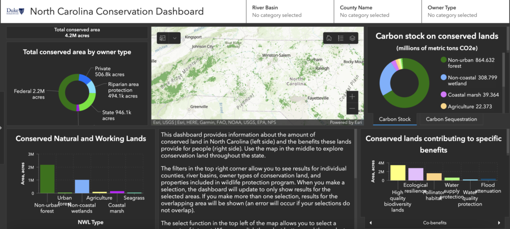
The tools are also part of a growing set of resources from the Nicholas Institute related to natural and working lands in North Carolina. Launched in January 2022, three online dashboards map the benefits of these lands, making detailed data easily accessible to communities, land managers, non-governmental organizations, and the general public. The dashboards allow users to quickly see these benefits by county, river basin or land type:
- Overview Dashboard – General information about the area and benefits of natural and working lands
- Conservation Dashboard – Focus on natural and working lands that are protected for conservation purposes
- Carbon Dashboard – Details about past, current, and potential carbon storage by land type
The NC Conservation Prioritization Tool and NC Conservation Benefits Calculator were designed by recent Duke University graduate Israel Golden, who holds dual master’s degrees in environmental management and forestry from the Nicholas School of the Environment. Support was provided by Open Space Institute and the Land Trust Alliance.

