A Path Towards Regional Flood Resilience Strategies

Rivers have molded the landscape of the entire state, with each river basin different from the other.

As an ecologically diverse state, with landscapes varying from the higher elevation of the western Blue Ridge mountains to the low-lying coastline in the east, within each region, one will experience differing average temperatures, manage different growing seasons for plants and agriculture, and enjoy a wide range of water bodies from lakes to streams, and small to large river networks.

North Carolina is home to roughly 37,853 miles of rivers, plus thousands of tributaries or streams that flow into and feed one of its larger river systems. In total, there are 17 river basins in North Carolina. Because every community falls within one of these basins, every community in North Carolina is impacted by the vast destruction to livelihoods caused by flooding.

We must address flood resiliency from the perspective of a basin-wide approach when recommending conservation solutions to mitigate its effects. 

Since each river basin is contrastingly unique, a one-size-fits-all approach is not applicable when designing strategies to mitigate flooding. The impacts look different by region, demonstrating why a basin-wide level approach is necessary to create manageable, coordinated intervention strategies to improve the flood risk for all communities in North Carolina.  
Understanding River Basins 

A river basin encompasses the area of land drained by a river and its tributaries. Each basin serves as a natural watershed, starting with the rainwater and flow of a central river system that shapes the landscape and ecosystems as the water moves through. River basins influence many concepts of the surrounding area, including local agriculture, urban planning and infrastructure, drinking water, wildlife habitat and diversity and the local economy. Each river basin in North Carolina has its own movement of water from the headwaters to an outfall into the ocean, an estuary, or another river.  

With the 17 river basins in North Carolina, each holds a unique ecological and topographical footprint in response to rainfall events that occurred upstream. Starting with rainfall, water accumulates into a basin that flows into subsequent bodies of water through a stream, river, tributary, groundwater, etc. As water accumulates and moves downstream, the river basin acts as a bathtub, collecting all contents and diverting where necessary.

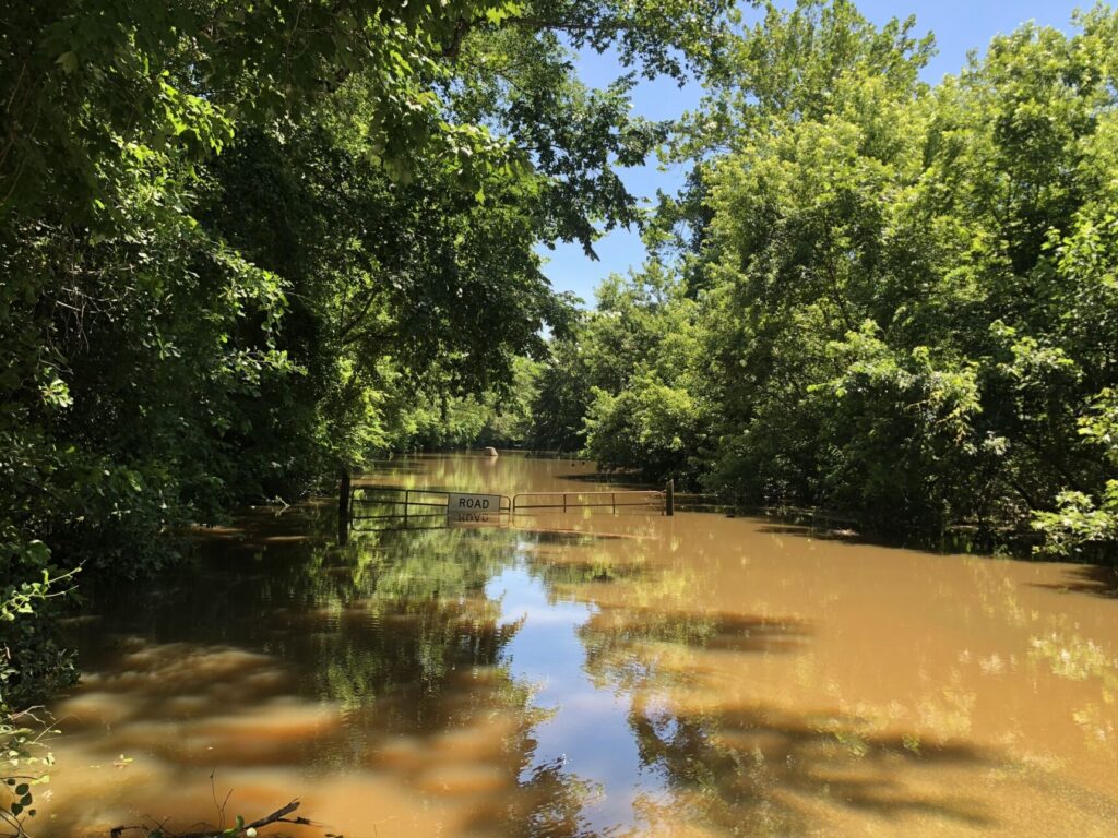
With more severe climate-change caused weather events, an influx of water to a river basin will cascade into surrounding areas, causing floods.   

The North Carolina Flood Resiliency Blueprint will serve as an online decision-support tool for policymakers, stakeholders and all North Carolinians with the knowledge required to make flood management decisions. The initiative was launched by the NC General Assembly and NC Department of Environmental Quality in collaboration with local and state agencies from across the state. In this process, having stakeholders present from various river basins is crucial to creating a tool that serves all communities and residents of the state.  

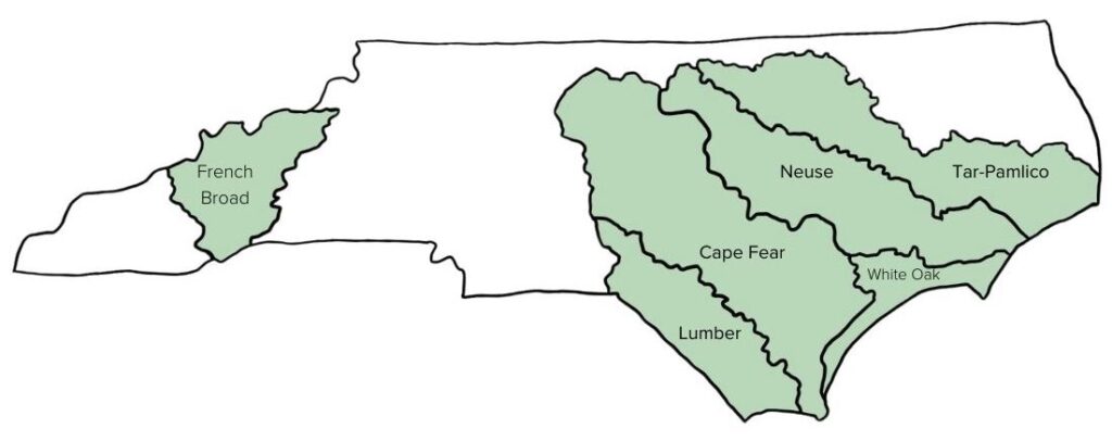
As a starting point for proposed flood mitigation action, the Blueprint process will develop basin-wide action strategies for six target river basins: French Broad, Tar-Pamlico, Cape Fear, Neuse, Lumber and White Oak River Basins.

Get to know these focus regions:
French-Broad  

  • Total miles of streams: 3,985 
  • Counties within basin: 8  
  • Size: 2,829 square miles 

CTNC has a deep history of conserving land in Western NC including throughout the French Broad River Basin. CTNC’s Land Protection Director, Rusty Painter, has culminated relationships in communities across this basin through the years to ensure that protected land offers solutions to climate change impacts including flood-related challenges. The Asheville Watershed conservation easement was originally designed to provide a sustainable, clean drinking water source for the City of Asheville, but it also serves as a collection vessel for water flow, helping slow water before it reaches the French Broad river.
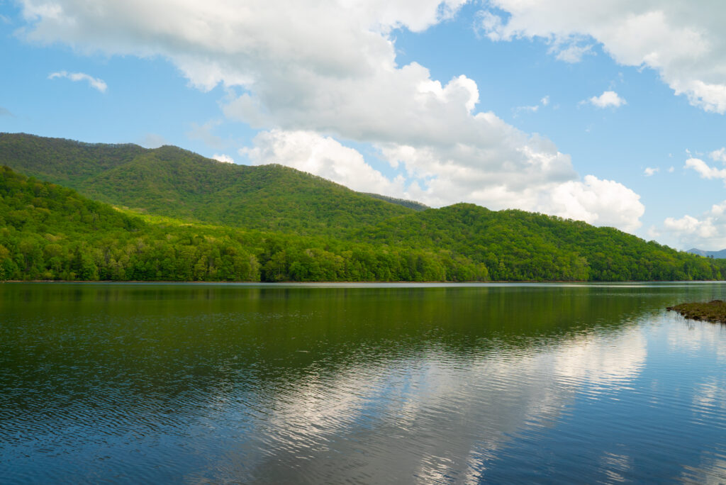
CTNC’s Western Conservation Manager, Aaron Flannery, highlights the importance of preserving land to enhance community resilience. “Protecting land in western North Carolina is crucial to the health of NC’s river basins that are fed from waters along the Parkway. Ensuring that the land along the Blue Ridge Parkway is preserved impacts everything that occurs downstream, including water quality, economic development, local and state parks, community resilience and the wildlife that calls the ecosystems of NC home.” 

Tar-Pamlico  

  • Total miles of streams and rivers: 2,521 
  • Counties within basin: 18  
  • Size: 6,148 square miles 

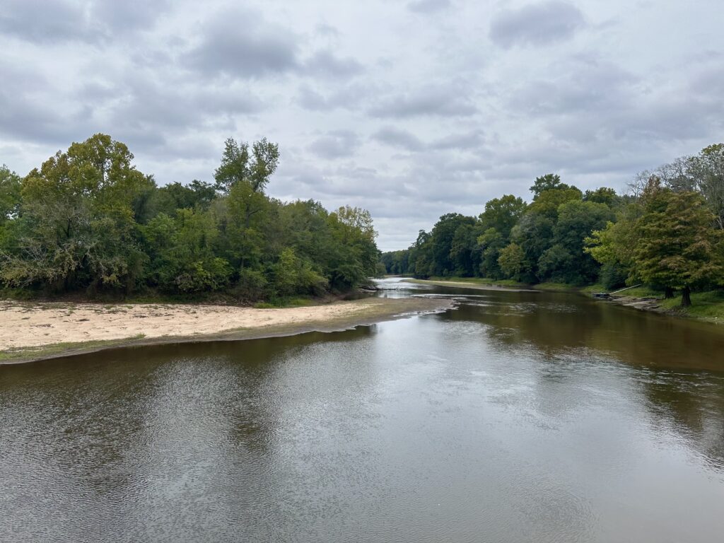
Princeville, NC is no stranger to the impacts of floods from the Tar River, a part of the Tar-Pamlico River Basin. CTNC’s partnership with the Town of Princeville and NC State’s Coastal Dynamics Design Lab inspired the development of CTNC’s Community Resilience Model. This map uses GIS technology to help identify communities at greatest risk to flooding where conservation solutions can provide a community benefit. The NC Flood Resiliency Blueprint will allow the integral flood mitigation work that occurred in Princeville to be utilized at a greater level – within entire river basins. 
Neuse 

  • Total miles of streams and rivers: 3,409 
  • Counties within basin: 18  
  • Size: 6,062 square miles 

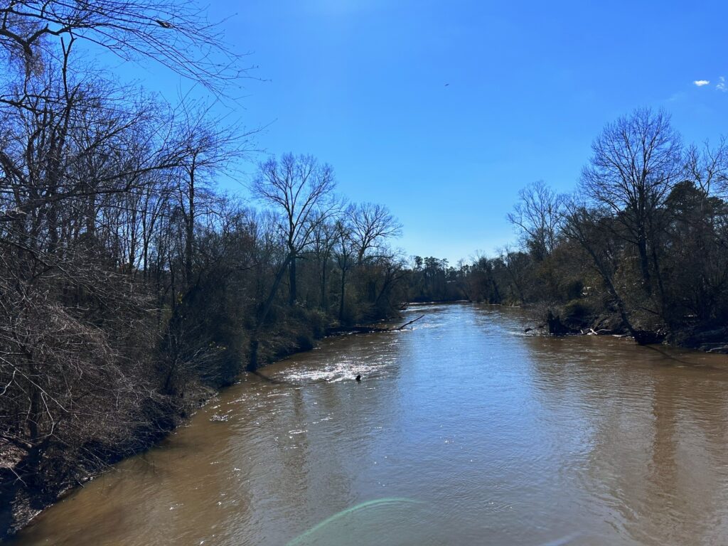
Serving as the third largest river basin in North Carolina, protecting the land along the Neuse River Basin is critically important to the cities within the basin by providing drinking water in nine dedicated reservoirs – Falls Lake, Lake Michie, Little River Reservoir, Lake Holt, Lake Orange, New Hillsborough Lake, Corporation Lake, Lake Ben Johnson and Lake Rogers. The basin also holds wetland forests that divert water from flooding nearby communities and captures runoff and rainfall to prevent impacts to downstream communities. For 12 years, CTNC partnered with the City of Raleigh to administer a watershed protection program, The Upper Neuse Clean Water Initiative, designed to raise funds to help land trusts protect land upstream of a rapidly growing region and critically important source of drinking water for the Triangle region.  
Cape Fear 

  • Total miles of streams and rivers: 6,584  
  • Counties within basin: 26  
  • Size: 9,164 square miles 

Lumber 

  • Total miles of streams and rivers: 2,247  
  • Counties within basin: 9  
  • Size: 3,329 square miles 

White Oak  

  • Total miles of streams and rivers: 320  
  • Counties within basin: 6  
  • Size: 1,382 square miles 

Community Expectations 

Protecting these bodies of water is crucial to the flow of water from the mountains to the sea. With the tool created in the Flood Resiliency Blueprint, members of each river basin’s communities can expect to gain a deeper understanding of their floodplain, the history of flooding in that region and the best strategies to combat the impacts of flooding specific to that area. 

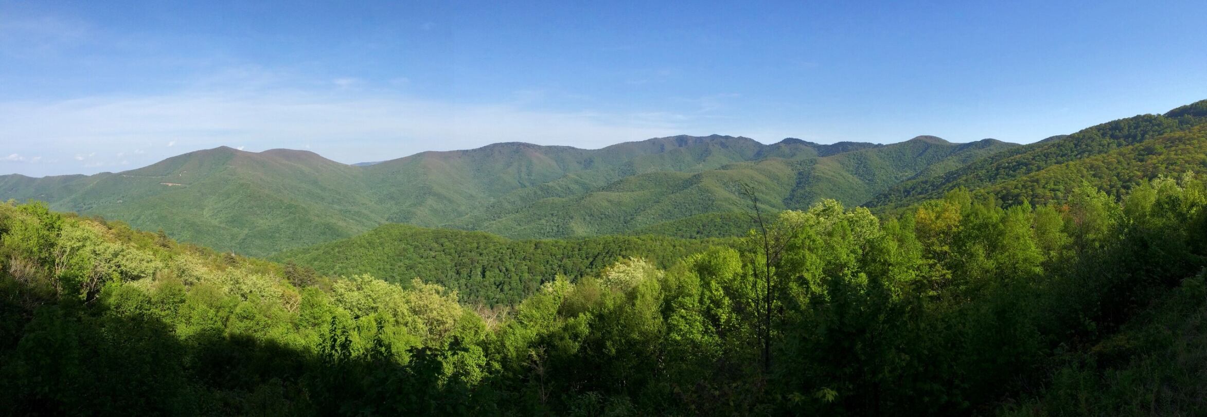
Collaboration from all regions of the state is important to ensure that all communities are represented and heard when creating tools like the Flood Resiliency Blueprint. The decisions made upstream in the Western part of the state will impact communities downstream throughout NC. To address the increasing threat of climate-change caused events, like flooding, community and county boundaries will be crossed to foster collaboration in creating effective solutions. CTNC’s relationships with local government organizations, statewide conservation partners and landowners will be prioritized to ensure a holistic approach to flood mitigation strategies occurs in communities across every river basin in North Carolina.  
CTNC Grants Fund Eight Conservation Projects in Western NC

Through the Mountain Revolving Loan Fund, CTNC allocates small grants to preserve critical areas of land protected and stewarded by our land trust partners.

Through the Mountain Revolving Loan Fund (MRLF), CTNC works with land trusts to conserve land in Western North Carolina. In addition to providing critical bridge loans to eligible land trusts, CTNC’s MRLF provides small grants to fill funding gaps that enable completion of projects that preserve the ecosystems and cultural sites along the Blue Ridge Mountains.

The CTNC Mountain Revolving Loan Fund has two significant benefits for our partners: 

  • It provides crucial bridge financing with minimal interest to land trusts in Western North Carolina to purchase conservation land and easements. As loans are repaid, the money becomes available to re-lend. 
  • A percentage of the balance of the loan fund is given out each year in grant awards. Grants of up to $25,000 are not required to be paid back. CTNC’s grants help cover transaction-related costs, land management, project administration, and long-term stewardship; often the most difficult project funding to raise.

This year, CTNC awarded grants to four land trusts totaling over $90,500. We’re proud to support the costs associated with ensuring that 516 acres of land will be protected in perpetuity. We look forward to more opportunities to work in partnership with key stakeholders to protect and steward this living legacy.

The land trusts that were awarded grant funds by CTNC during the current cycle include: 

  • Blue Ridge Land Conservancy  
  • Conserving Carolina 
  • Highlands-Cashier Land Trust 
  • Mainspring Conservation Trust 

The eight properties that will be protected by our partner land trusts offer ecological, agricultural, recreational, and cultural-historic benefits to communities of Western NC.

“The projects and properties supported by this year’s grant awards will enhance collaborative partnerships with local land trusts working toward the common goal of conserving land and ensuring that the future of Western NC landscapes are protected,” CTNC’s Land Protection Director Rusty Painter said. “The land conservation work done by CTNC and our partners is critical to serving community needs and combatting the impacts of the climate crisis.”

CTNC is proud to partner with organizations across the state to accelerate our collective efforts to build a more resilient state.

Along with the conservation values of these properties, each contains crucial ecological and agriculture benefits to the local landscape and communities of Western NC.


CTNC’s support of statewide conservation initiatives is made possible through generous donations from CTNC supporters. Your generous support enables us to carry out our mission to foster community resilience in Western NC and throughout our amazing state.

CTNC and Bald Head Island Conservation Partners Collaborate to Build New Prioritization Tool

Climate and Conservation Resilience Data to Drive Future Land Protection on Bald Head Island

The beauty and unique ecology of Bald Head Island needs to be protected. The abundant nesting sea turtle population, vital maritime evergreen forest, and coastal ecosystems need specialized care to ensure they survive for generations. This summer, CTNC and partners on the island teamed up to develop a conservation prioritization tool that will inform how to deploy future work. 

Since 2001, CTNC has collaborated with the Bald Head Island Conservancy and Smith Island Land Trust (SILT) to conserve habitat on Bald Head Island in Brunswick County. CTNC holds 28 conservation easements on Bald Head Island, the southernmost barrier island in the state and a true ecological gem.

The Bald Head Island Conservation Prioritization Tool, developed by Hanna Bliska, a CTNC 2023 Stanback Summer Fellow, is a model that identifies individual properties on the island with the highest conservation value. This will enable Smith Island Land Trust and its partners to focus efforts and limited resources on properties with the most significant conservation impact.

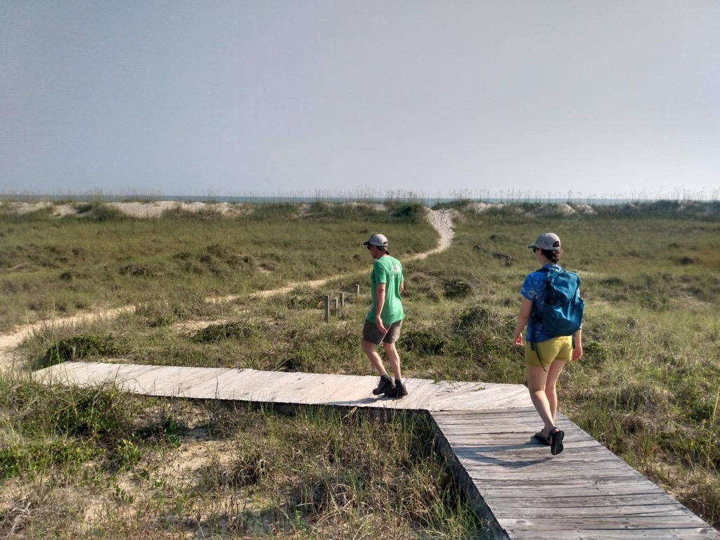
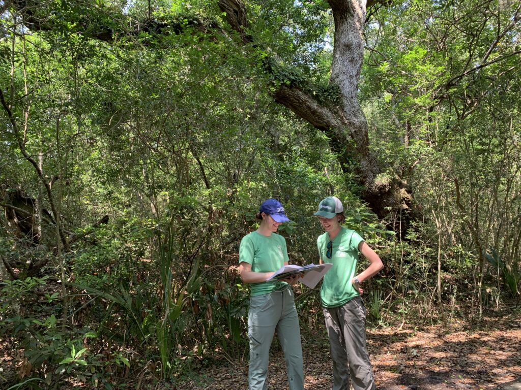
CTNC Summer Fellows Hanna Bliska (left) and Emma Childs (right) visited Bald Head Island in June to ground-truth the results of the prioritization model. 

To make the tool come to life, Hannah collaborated with CTNC Bald Head Island conservation partners and CTNC staff to build the prioritization tool in ArcGIS. This tool is inspired by CTNC’s Blue Ridge Parkway prioritization model that we use to streamline efforts and strategic goals. The plan focuses on protecting undeveloped land on Bald Head Island. The model has incorporated a variety of ecological data, including data on coastal and terrestrial resilience to climate change developed by The Nature Conservancy. 

Undeveloped acreage is critical to both natural and human success on the island. Beyond protecting vital forested and coastal areas, these conserved acres become buffers to soften the impacts of climate change on Bald Head Island. The maps inform SILT’s communications with landowners and educate islanders about conservation opportunities. This will, in turn, ensure a resilient future for the communities that call Bald Head Island home.

The Bald Head Island Conservation Prioritization Tool further demonstrates CTNC’s commitment to creating sustainable programs in collaboration with partners to utilize data-driven approaches to conservation. SILT will maintain the tool to update it as more conservation progress is made on the island. Through partnerships like this, CTNC is helping North Carolina build resilience in the face of climate change.

Thank you to the development team – Hanna Bliska, Rusty Painter, Mary Alice Holley, and Emma Childs. Funding for the project was provided by SILT and Hannah’s time with CTNC was made possible by the Stanback Fellowship Program at the Nicholas School of the Environment at Duke University.

30 Acres Conveyed to the Park Service Along Mountains-to-Sea Trail

Conservation Trust for North Carolina (CTNC) recently transferred a 30-acre property to the National Park Service (NPS) to expand the boundaries of the Blue Ridge Parkway in Watauga County. The Elk Mountain Meadow tract shares a quarter-mile boundary with the Blue Ridge Parkway and lies just a few dozen feet from the Mountains-to-Sea Trail (MST) near Elk Mountain Overlook.

Portions of the property are visible from the Blue Ridge Parkway and MST near milepost 274, just off Highway 421 near Deep Gap. Conservation of this tract complements CTNC’s protection of an 86-acre property, just across the Parkway below Elk Mountain Overlook and our recent 408-acre acquisition adjacent to that one.

The Elk Mountain Meadow property protects water quality in a tributary of Gap Creek, and the Mountains-to-Sea Trail passes within feet of this property, ensuring a more desirable experience for hikers.

The addition of the Elk Mountain Meadow property to the Parkway will help increase the connectivity of protected lands in the area to preserve the natural corridor while ensuring a forested buffer along this section of the MST. Conserving land along the Blue Ridge Parkway also enhances the landscape’s resilience to our changing climate by providing protected places where ecological diversity can resist damage and migrate safely to more hospitable areas.

“Protection of properties like this contributes to the integrity of the Blue Ridge Parkway, which attracts millions of visitors to the High Country each year. The addition of the Elk Mountain Meadow property also enhances the experience of hikers along this section of the Mountains-to-Sea Trail on the outskirts of Boone.

“Conserving more land is so important to the future of our country” said the previous owner who sold the property to CTNC in 2017.

The Conservation Trust for North Carolina has now conserved 76 properties on the Blue Ridge Parkway, totaling 34,779 acres.

###

Gardens Spring Up Across Princeville

Stormwater interventions offer climate solutions

As communities experience increasingly heavy rainfall, communities across North Carolina are experiencing nuisance flooding. Instances of standing water can disrupt routine day-to-day activities, put added strain on infrastructure systems such as roadways and sewers, and cause minor property damage. 

The town of Princeville knows that well, as do many climate-impacted towns in North Carolina. A spot of historic and devastating flooding as well as every-day challenges resulting from nuisance flooding, this town invested in building natural stormwater capture devices while enhancing once-vacant land throughout the community.
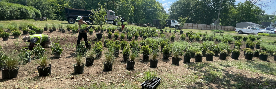
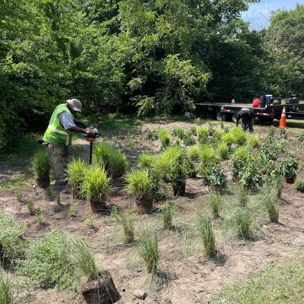
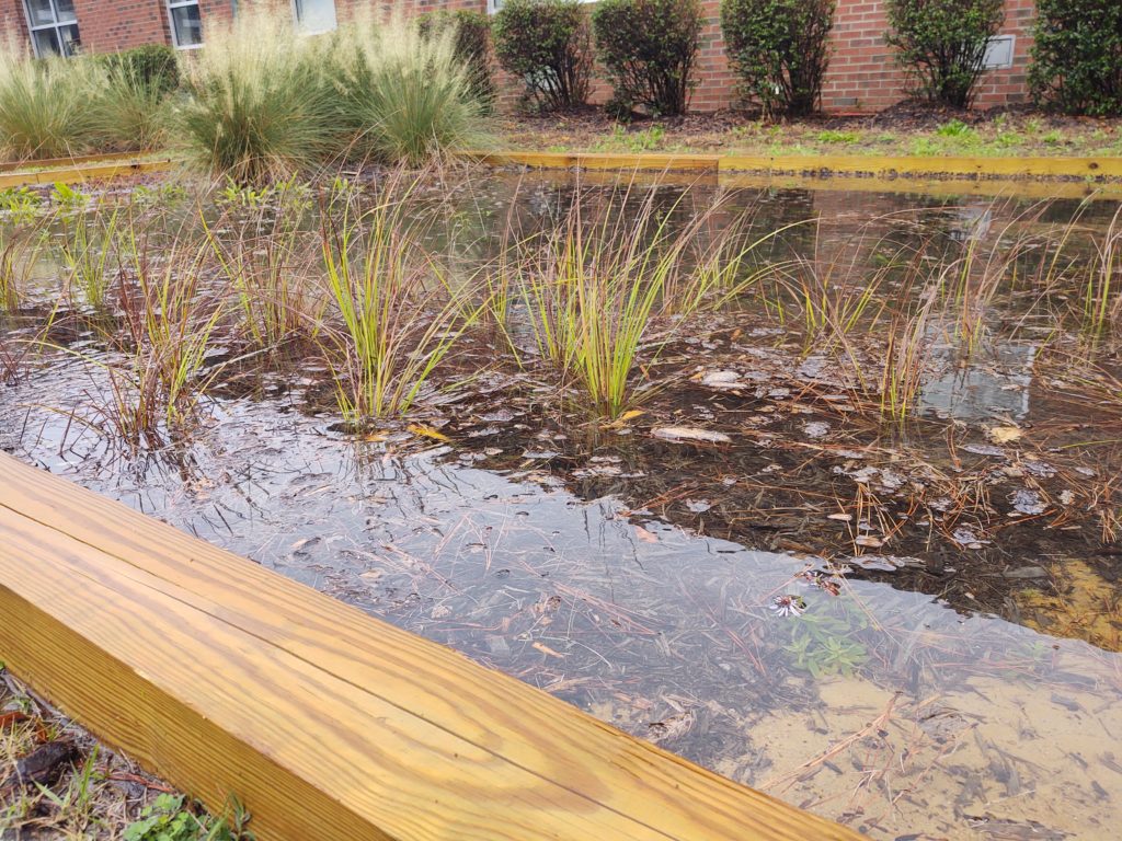
In the summer of 2023, CTNC spearheaded a project to install green infrastructure with wetland enhancement projects on vacant, town-owned parcels along the Tar River. These are now sites where stormwater can naturally flow and reduce nuisance flooding that causes inconveniences to residents, roads, and neighborhoods in populated areas. The project created 6,000 square feet of stormwater retention strategies, including bioretention cells and rain gardens designed to hold 27,740 gallons of water per rain event.

Princeville elected leaders worked with residents and partners to identify three locations throughout town where standing water was already creating safety hazards following large rain events. By turning these sites into managed wetland areas with trees, shrubs, and pollinator plants, each site can now absorb stormwater and address standing water issues. This is all while beautifying each plot with seasonal colorful blooms and leaves, supporting native wildlife, including birds and other pollinators.

GARDENS ARE READY TO BLOOM

Site 1 is located at Town Hall and Freedom Hill to help add stormwater runoff at a high-traffic intersection of Princeville. The site includes NC native pollinator plants including Soft Rush, Walker’s Low Catmint, and Black-eyed Susan.

Site 2 is located at the corner of Church and Walston Streets, and Site 3 is located at the corner of Beasley and Walston Streets. These locations were selected due to their proximity to the elementary school rain garden installations completed in 2020.

The project is continuing with an important science component. The Town of Princeville seeks to incorporate community education into every conservation project that takes place. In the case of the stormwater infrastructure improvements, CTNC received funding from TELUS to purchase sensors that track the water absorption rate of the wetland areas. These sensors are offered by Temboo, a technology company that utilizes data to engage communities in understanding their environmental impact locally. The sensors will be installed this summer and will collect data that will be shared with town leaders, educators, students and families to showcase the importance of conservation as a natural solution to flooding and other climate-related issues being experienced by Princeville and surrounding communities.

RAIN GARDENS & WETLAND ENHANCEMENTS OFFER A CLIMATE SOLUTION

Communities across North Carolina are experiencing greater occurrences of precipitation and rain events that cause minor and major flooding. Conservation solutions, like installing rain gardens and other stormwater management techniques, are a great way to manage flood water while benefiting communities and residents. These types of installations are beautiful, offer a benefit to wildlife like birds and pollinators, effectively manage stormwater, naturally filter contaminants from water flow before it reaches a river or stream, and are low maintenance options for long-term care. CTNC supports natural solutions like stormwater infrastructure to benefit communities seeking to build resilience to flood challenges exacerbated by our changing climate.

The stormwater designs and plant selections were created by NC State Coastal Dynamics Design Lab based on recommendations from the Princeville Community Floodprint. It was informed by input from Princeville residents and approved by the Town of Princeville Board of Commissioners. The project will be installed by M&M Landscaping – a local contracting partner participating in the conservation projects being funded through CTNC.

Funding for this project was generously provided by the Commission for Environmental Cooperation EJ4Climate grant.

Stella’s Acres Joins Another CTNC-Protected Parkway Property

A Full Circle Moment for Blue Ridge Parkway Land Protection

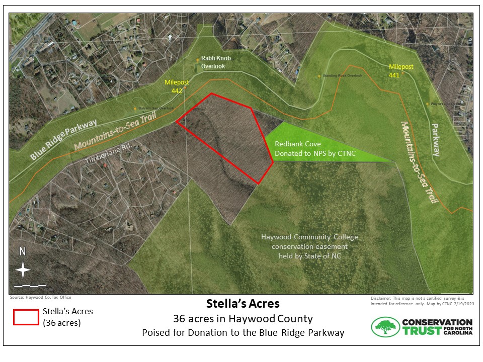
In June, CTNC secured another 36 acres of pristine protected views along the Blue Ridge Parkway. The property known as Stella’s Acres abuts the very first property CTNC ever conveyed to the Blue Ridge Parkway – our 22-acre Redbank Cove property, donated to the National Park Service in 1997.

This new plot lies along Timberlane Road, just northeast of Balsam in Haywood County. The tract adjoins the Parkway at milepost 442. Protection of the land will enlarge the protected habitat connection between the Parkway and the 328-acre Haywood County Community College conservation easement property.

“We are thrilled to announce this success and look forward to celebrating the transfer of the property to the Blue Ridge Parkway in the very near future. We are especially grateful for the generosity of the land donors and the support of National Park Service staff, without whom we could not carry out this important work,” said Rusty Painter, CTNC Land Protection Director.

This land holds ecological value, protects clean water, and augments climate solutions to Western North Carolina communities.

A stream originating on the property flows into Richland Creek, which continues into the Town of Waynesville through a municipal park and Richland Creek Greenway. Protection of this headwater stream further ensures clean water from the source to communities downstream. Furthermore, protecting headwater streams helps mitigate the impacts of downstream flooding during heavy rain events.

This is a value add for climate mitigation as the property’s mature hardwood forest allows for carbon sequestration from the atmosphere and protection of carbon stored in the soil. Additionally, CTNC’s protection of the property expands protected acreage along the Parkway’s south-to-north habitat migration corridor, enabling plants and animals to escape to northern latitudes with cooler climates.

CTNC’s partnership with the National Park Service ensures long-lasting preservation of an iconic area of our state.

Millions of visitors to the Parkway (locals and tourists) will benefit from protection of scenic properties like Stella’s Acres and others like it. The property is visible from the Parkway, especially while driving north from Balsam Gap Overlook, as most of the tract rises upslope from the Parkway toward the ridge of Wesner Bald. At its closest point, the property is as little as 320 feet from the Parkway motor road. The property is also highly visible from a nearby section of the Mountains-to-Sea Trail. While not accessible by public transportation, the Blue Ridge Parkway is free to all visitors, unlike many national parks that charge user fees. Public access to nature is always a value add.

Thank you to the National Park Service, previous landowners Charles & Donna Bryan, and our corporate donor for making this project possible. The property will be donated to the National Park Service in the next few years.

This is the 76th property CTNC has protected along the Blue Ridge Parkway. Still, more is needed, as most land visible from the Blue Ridge Parkway is privately owned with no land use restrictions, leaving it vulnerable to destructive land uses that can compromise the scenic views that attract millions of visitors each year.

Join us in this effort to conserve vital land in an effort to build resilience for communities in Western North Carolina.

Flowering Trees Put Down Roots for Climate Resilience in Princeville

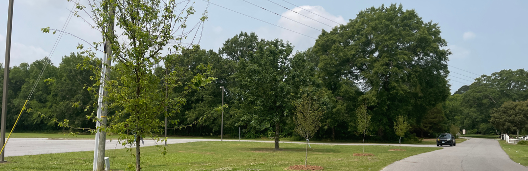
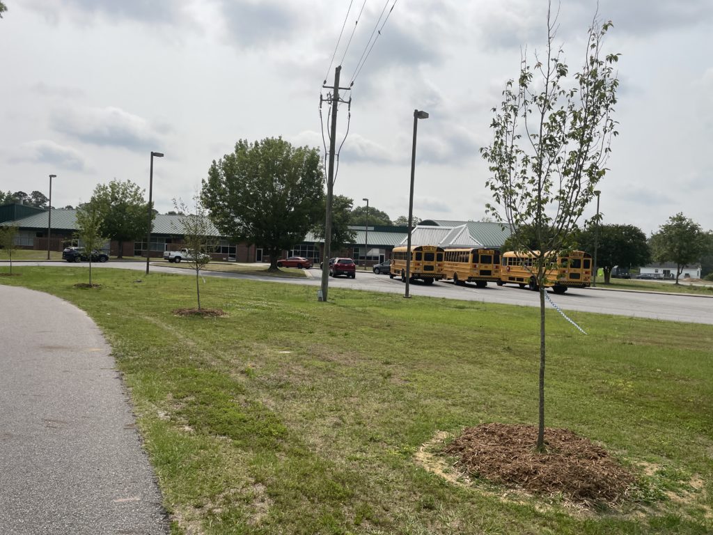
The streets of Princeville are now lined with flowering native trees, thanks to your support and federal grant funding. This beautification project puts down roots for future flood resilience and carbon sequestration.

The project, completed in the spring of 2023, planted 50 native trees along streets within Princeville’s historic core. Trees were selected through a community-input process where residents were invited to learn about the ecological benefits of street trees and vote for their favorite trees. The trees selected were eastern serviceberry, red maple, and musclewoods.

The trees were chosen for their ability to:

  • Provide beautification to Main Street and surrounding neighborhoods,
  • Showcasing seasonal colorful blooms and leaves,
  • Support native wildlife, including birds and other pollinators,
  • Absorb stormwater from flood-prone areas and carbon from the atmosphere, and
  • Reduce the temperature of sidewalks for pedestrians.

This project resulted from the Commission for Environmental Cooperation EJ4Climate grant awarded in 2022. It serves as a model for other flood-prone cities to make natural adjustments to stave off the increasing impacts of climate change.

Conservation can provide solutions for communities seeking to build resilience to projected and future climate change impacts – including flood, fire, drought, and food insecurity. Tree planting projects – also known as urban greening – that increase the number of small and medium trees located within a town footprint are known to provide multiple climate and community benefits, including:

  • Combat air and noise pollution
  • Soak up rainwater that may otherwise create flooding
  • Create a habitat for local wildlife
  • Offset carbon emissions in the local area
  • Increase resident satisfaction with physical and mental health benefits

In partnership with the Town of Princeville, the tree plan was designed by NC State Coastal Dynamics Design Lab based on recommendations from the Princeville Community Floodprint. It was informed by input from a Princeville resident online survey and approved by the Town of Princeville Board of Commissioners. The trees were installed by M&M Landscaping – a local contracting partner participating in the conservation projects being funded through CTNC.

The partnership with the Town of Princeville is ongoing, and the need to address stormwater and flooding challenges is great. With additional funding and coordination with the local community, we plan to expand our footprint and include more tree plantings in future years. Be part of helping build a more resilient North Carolina. Explore your donation opportunities now.

Park land around Jeffress Park expands

CTNC’s ongoing partnership with the National Park Service enhances the community resiliency and visitor experience for residents and visitors of Western North Carolina and the Blue Ridge Parkway.

Conservation Trust for North Carolina has transferred 408 acres of forestland near the intersection of the Blue Ridge Parkway and Highway 421 at Deep Gap. The property adjoins the Parkway between milepost 272 (Cascades Parking Area) and 273.5 near Elk Mountain Overlook, at E.B. Jeffress Park.

This land adjoins the Blue Ridge Parkway along its western and northern boundaries and is located just below Tompkins Knob Overlook, near the Cascades Trail and E.B. Jeffress Park picnic area. It lies along the Blue Ridge Escarpment, with its higher elevations visible from the Blue Ridge Parkway and parts of the popular Cascades hiking trail. It also provides a natural buffer for the Mountains-to-Sea Trail that parallels the Blue Ridge Parkway along the northern boundary of the property and the 0.6-mile Tompkins Knob trail to Tompkins Knob Overlook above the property.

This latest conservation project builds on continuing efforts to expand public land around Jeffress Park, named for a native North Carolinian who was instrumental in routing the Blue Ridge Parkway through Western NC. This newly protected property is a key part of CTNC and Blue Ridge Conservancy’s conservation work in this area. Jeffress Park is the largest block of protected land along the 55-mile stretch of Parkway between Moses Cone Park and Doughton Park. Millions of visitors to the Parkway (locals and tourists) will benefit from the expansion of this ‘conservation node’ that’s a popular destination for tourists and locals from Boone, North Wilkesboro, and Winston-Salem.

Expansion of protected land along the Blue Ridge Parkway enhances its importance and effectiveness as a south-to-north habitat migration corridor, enabling plants and animals seeking cooler climates to migrate to northern latitudes. This property also allows species to move upward from the foothills to cooler sites at higher elevations. The permanently protected forests on this property will continue to sequester carbon from the atmosphere. Protection of headwater streams will help mitigate the impacts of downstream flooding during heavy rain events.

This conservation achievement was made possible by the generosity of the landowners who donated a portion of land value that reduced the overall purchase cost. This reduction enabled CTNC to purchase the property and secure another win for America’s most popular National Park unit. We’re proud to have facilitated the acquisition and transfer of this property to the National Park Service for permanent protection.

With three other nearby and adjoining properties already transferred to the park service by CTNC, and another pending conveyance of 72 acres by Blue Ridge Conservancy, the amount of public land around E.B. Jeffress Park will collectively almost double.

Your donations help us to continue the expansion of protected property in Western North Carolina. Thank you for your continued support of our work as we expand the boundaries of the Blue Ridge Parkway one property at a time.

Landowners participating in the Sustainable Forestry and Land Retention Project.

Training Future Practitioners to Protect Heirs Property Landowners

As much as 4% of all property in North Carolina is held as heirs’ property, yet only a handful of organizations in North Carolina provide legal services to protect landowners. This land, valued at approximately $2 billion, should be retained by families instead of being lost through forced partition sales.

Thanks to the support of an anonymous donor and the NC Heirs’ Property Coalition, CTNC has pledged $50,000 to fund the new Heirs’ Property Project of the Wake Forest Law Environmental Law and Policy Clinic. Now, families facing heirs’ property difficulties can receive direct legal services from skilled attorneys and law students. Beyond legal help, this project strives to support, train, and provide a framework for other legal practitioners, to help stem the rate of land loss in North Carolina due to forced partition sales.

Through this project, 24 Wake Forest Law students will be trained each year in practical approaches to resolving heirs’ property issues, and to develop two CLEs per year to train practicing attorneys in helping families navigate the realities of communal land ownership and heirs’ ownership.

This project will help folks keep property in their families, resist unwanted development, enhance their farming or forestry practices, and build wealth to weather natural disasters and economic downturn. By addressing heirs’ property, families can create a legal structure for managing their land as a performing asset over the long term.

CTNC has a long history of funding innovative ideas that amplify the impact of conservation in ways that benefit communities across North Carolina. The North Carolina State Legislature has not yet adopted the Uniform Act to provide the necessary due process to protect families from forced partition of land. By designating funding to make this clinic possible, we are able to provide support to families in need so they are able to retain ownership of their land and continue to access the benefits that conservation can provide.

New Frontier For Protecting Heirs’ Property
The project also builds a new node in the network of organizations tackling heirs’ property issues and addressing land loss among African-Americans, Native Americans, and other disadvantaged communities in North Carolina. The Clinic will build capacity for future efforts to resolve heirs’ property in North Carolina, and potentially serve as a model for other law school clinical projects in the Southeast. Organizations working on heirs’ property issues, including the Land Loss Prevention Project, Legal Aid of North Carolina, and Black Family Land Trust, have supported launching a law school clinical project to reinforce their own efforts.

Working with partner organizations, the Heirs’ Property Project will provide direct legal representation alongside conflict resolution and land management support. The Heirs’ Property Project will assist in three ways:

  • By providing direct representation to heirs’ property owners,
  • By building a pipeline of lawyers trained to handle heirs’ property cases, and
  • By serving as a hub for research and interdisciplinary training on land rights issues in North Carolina.

In addition to producing a pipeline of students with training in heirs’ property issues, the project will engage students and scholars in research on land rights’ issues, contributing to practical knowledge about the prevalence, consequences, and social context of heirs’ property—as well as to broader conversations about the economic, social, and political trajectory of rural spaces.

Conversations are underway as to how heirs’ property issues can be included in Wake Forest Law’s curriculum more generally as well. Most importantly, the project will convene expert practitioners to provide training in heirs’ property and related issues to practicing North Carolina attorneys, and to foster an interdisciplinary approach to supporting rural communities as they protect and steward their land. The project will partner with other North Carolina law schools and organizations to help address heirs’ property issues in the state at scale.

The Heirs’ Property Project at Wake Forest will convene a Board of Advisors to provide collaboration and support to students and families. Director of Community Innovation Mary Alice Holley will represent CTNC as a member of the board.

Other coalition members have also pledged to find funding to support this effort over the next two years in addition to our ongoing effort to encourage the NC Legislature to adopt the Uniform Act for NC.

What is Heirs’ Property?
When landowners die without a will, their surviving family members are each left with a fractional interest that lacks many legal protections and privileges. Such land, called “heirs’ property,” is concentrated in communities of color and low-income communities. Owners of heirs’ property face unique difficulty improving their land, stewarding its environmental condition, and securing it against predatory development.

Landowners participating in the Sustainable Forestry and Land Retention Project.

Holding land as tenants in common and heirs’ property can make the property vulnerable to forced sale. When family members decide they want to sell their share, or a non-family member or developer acquires a share of the property, they may be able to force the partition of the property into smaller pieces, thus fragmenting the land. They may also be able to force the sale of the property without a right of first refusal for other family members or a guarantee of fair market value.

Holding land as heirs’ property can make it difficult or impossible to access credit markets, as clear title cannot be demonstrated. It can also slow or frustrate access to government support for agriculture and/or disaster aid.

Led by a supervising attorney, this project will enroll ten or more students each semester to provide legal services to clients referred from partner organizations. The project will represent heirs’ property owners as they clear title to their land, resolve adjacent legal issues like boundary disputes, and navigate state and federal land management programs—partnering with the Wake Forest Divinity School to provide clients with skilled support for family decision-making processes, as well as with environmental experts to support heirs’ property owners in stewarding their land. Embracing the model of community lawyering, we also expect the project to serve as a legal advisor and first point of contact for local community organizations confronting threats to rural land and community autonomy.

Thank You to Generous Funders
Thanks to donors and supporters, the project launched in January 2023 and is funded through December 2024. Additional thanks to the Skadden Foundation, Wake Forest University’s Provost Office, American Farmland Trust, and Black Family Land Trust for helping make this project a reality.

Contact for Heirs’ Property Legal Assistance
Contact the Environmental Law and Policy Clinic via Jesse Williams for information about the Heirs’ Property Project of the Wake Forest Law Environmental Law and Policy Clinic.

Special thanks to Jesse Williams for contributing to this article.

Protecting the Woodfin Creek Headwaters

This past Valentine’s Day, CTNC gave another gift of land to the National Park Service. CTNC donated its 21-acre Woodfin Creek Headwaters property to the Blue Ridge Parkway. The property contains the headwaters of Woodfin Creek and offers scenic views from the Blue Ridge Parkway, the most-visited unit of the National Park Service. It is an example of a successful public-private partnership that benefits all of us who appreciate public lands and the natural beauty of Western North Carolina.

“We are extremely grateful for a generous landowner who was willing to donate property to CTNC to help us achieve our shared goals of permanently protecting the places we all love,” said Rusty Painter, Land Protection Director. “The Woodfin Creek Headwaters property is a shining example of how one person’s generosity can benefit many people, including generations to come.”

The Woodfin Creek Headwaters property is nestled within the Mount Lyn Lowry – Campbell Creek State Natural Area, as designated by the NC Natural Heritage Program. According to the site report prepared by ecologist Owen Carson with Equinox Environmental, globally-significant pockets of spruce-fir forests like those found on this property are characteristic of forest types found as far north as Canada. Mr. Carson’s site report states that the property “contains a wealth of existing conservation values and has the potential to support a considerable number of rare plant and animal species.”

The Woodfin Creek Headwaters is visible when driving south along the Blue Ridge Parkway toward Waterrock Knob. The tourism economy of Western NC is highly dependent on undisturbed views from the Parkway and its hiking trails and other amenities. Most land visible from the Blue Ridge Parkway is still privately owned, with no land use restrictions, leaving it vulnerable to destructive land uses that can compromise the scenic views that attract millions of visitors each year.

This donation furthers CTNC’s mission to deliver conservation that is inclusive, supportive and meaningful conservation for all communities. This area contributes to so many bottom lines that impact North Carolina:

  • Climate Resilience – Expansion of protected land along the Blue Ridge Parkway enhances its importance & effectiveness as a south-to-north habitat migration corridor, enabling plants and animals to migrate to northern latitudes to cooler climates. The permanently protected forests on this property will continue to sequester carbon from the atmosphere.
  • Community – Millions of visitors to the Parkway (local and tourists) will benefit from scenic protection. Land conservation around Waterrock Knob has been a multi-partner effort over the past ten years, including local and national land trusts and the National Park Service. Expansion of this ‘conservation node’ enhances recreation opportunities benefiting nearby communities, including the Qualla Boundary, owned by the Eastern Band of Cherokee Indians.
  • Equity – While not accessible by public transportation, the Blue Ridge Parkway is free to all visitors, unlike many national parks that charge user fees.

The property was generously donated by a real estate investor based in Florida in 2017. Donations by supporters like you covered the transaction-related costs of accepting and holding the property until it was donated to the National Park Service. Thank you to all who support our work!

Categories