fbpx

Checking in with Our Resilience Corps NC Partners

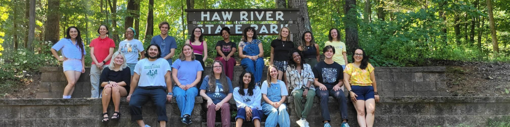
As AmeriCorps members are halfway through their service term, tangible evidence of community resilience emerge

CTNC is working alongside our partners to build a network of service throughout North Carolina. The Resilience Service Network brings together the expertise of CTNC, Conserving Carolina, and Conservation Corps NC to leverage the investments of AmeriCorps to build capacity of nonprofits, local governments, and agency partners to achieve resilience.

Members of 
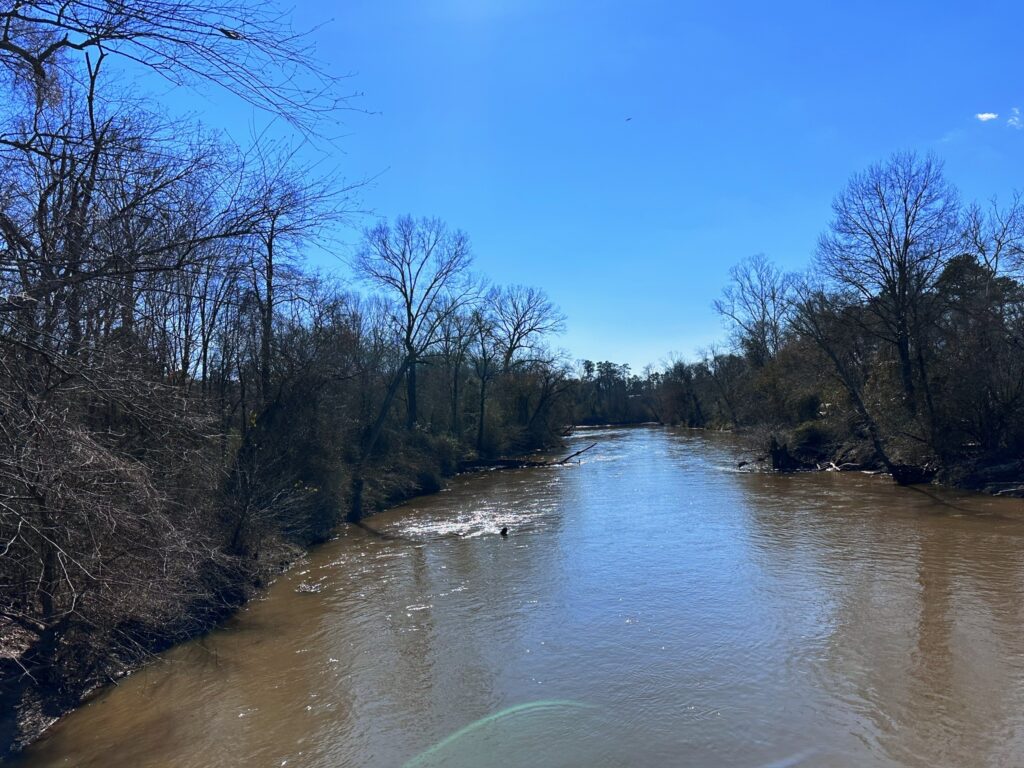
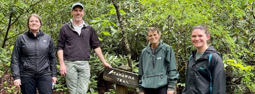
CTNC’s AmeriCorps program, Resilience Corps NC, has partnered with 20 host site partners to deploy 23 members in service to communities with climate risk and capacity needs. These members are now halfway through their service term, which began in September of last year. With members serving in over forty communities across the state, tangible evidence of community resilience is present.  

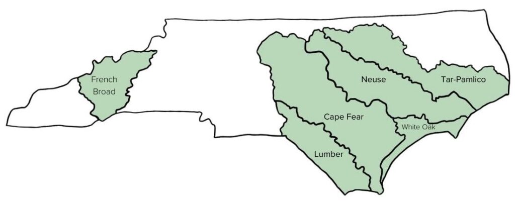
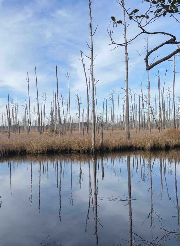
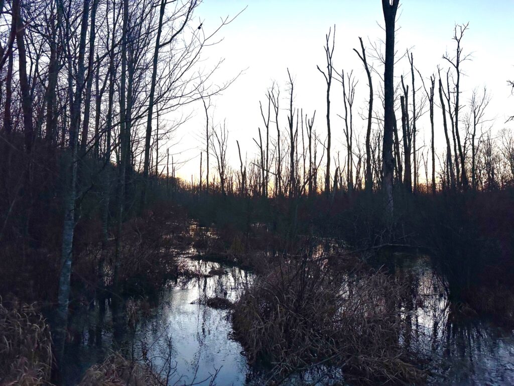
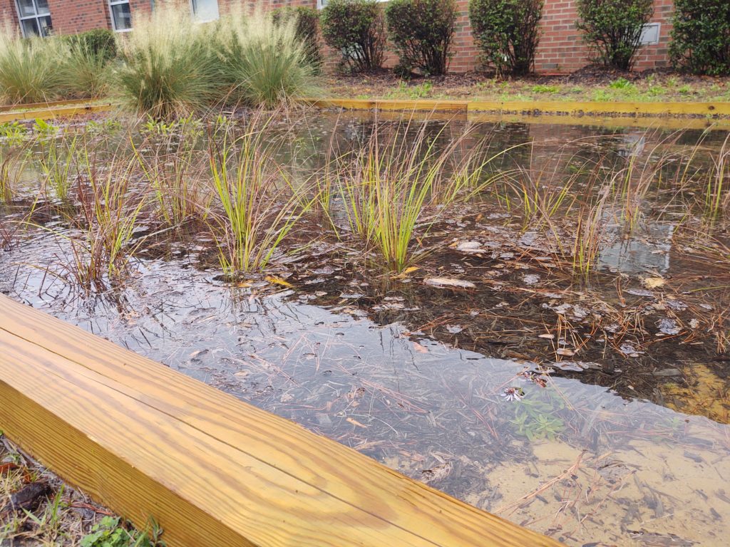
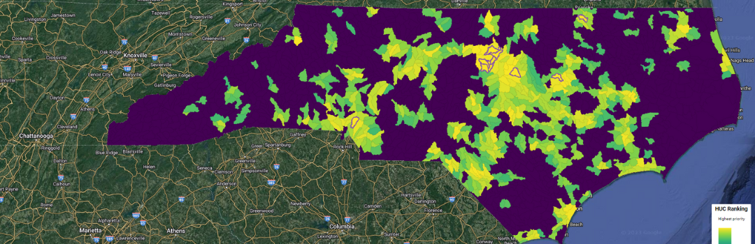
How do we select these community partners? CTNC seeks to prioritize community partnerships where a high climate-risk to flood, fire, food insecurity, or urban heat effects is affecting socially vulnerable communities and people throughout North Carolina. Using data assessments found in our Community Resilience Model, a GIS map that pinpoints the communities of NC that could benefit the most from climate change resilience work, we can ensure our AmeriCorps partnerships are delivering on CTNC’s goals to build resilience throughout the state.   

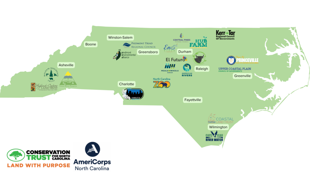
See where our partnerships are growing resilience: 

The Resilience Service Network Case for Support demonstrates the need for additional capacity in vulnerable communities across the state. By building capacity in partnership with local leaders, the work being accomplished by these members will successfully increase the capacity of what each organization can accomplish.  

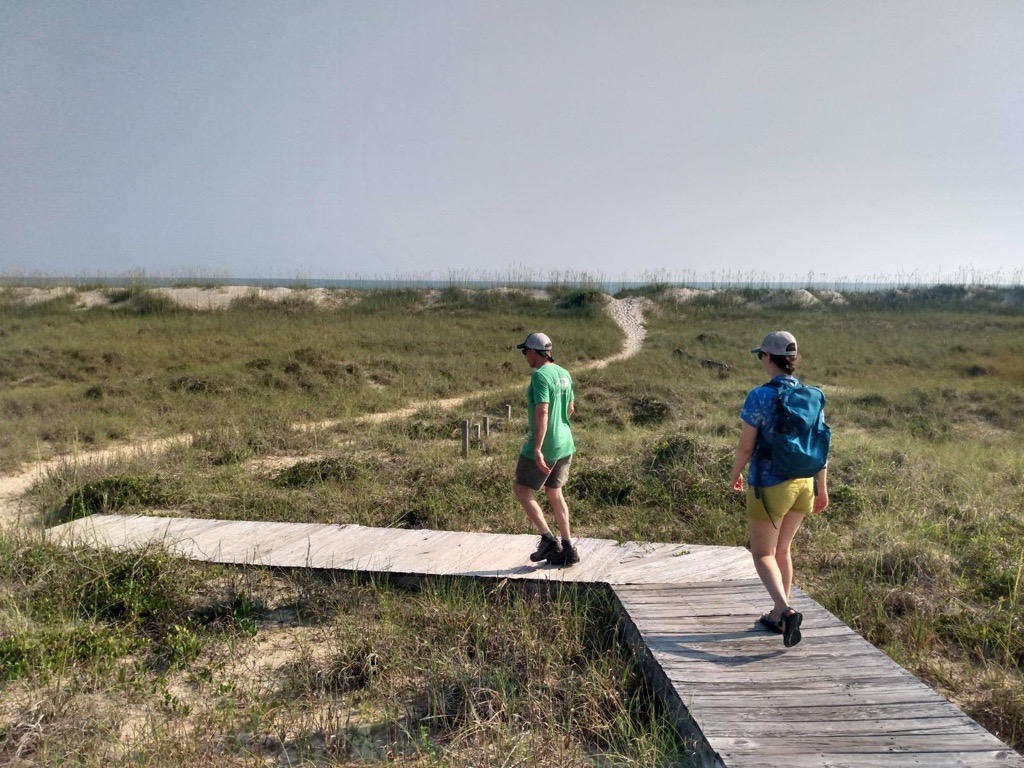
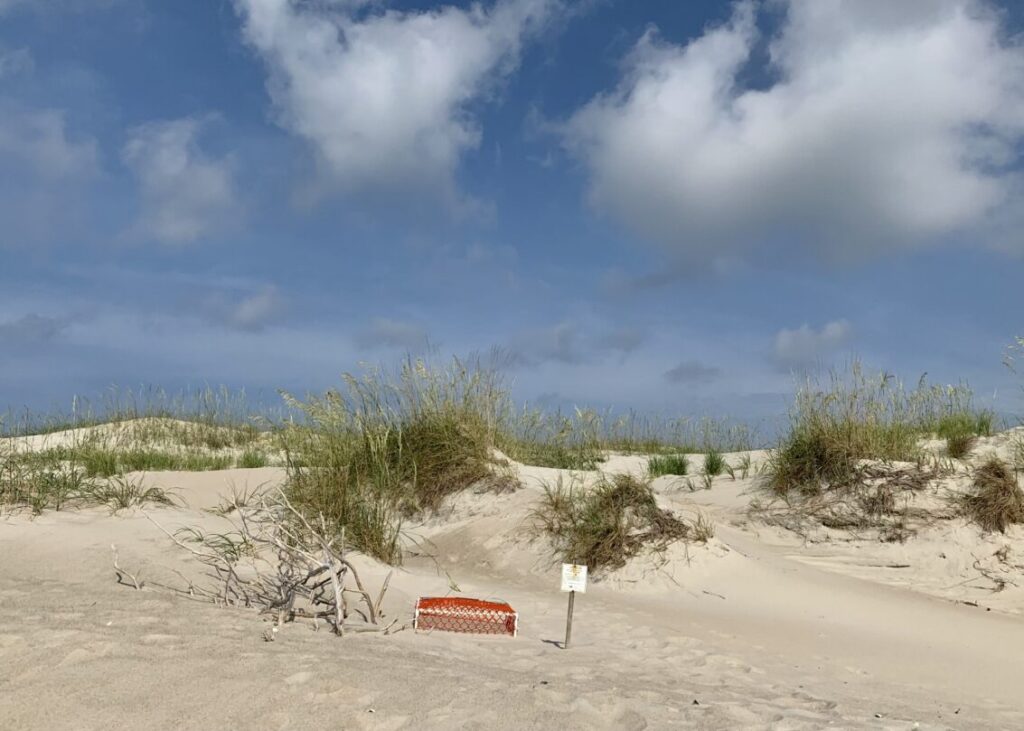
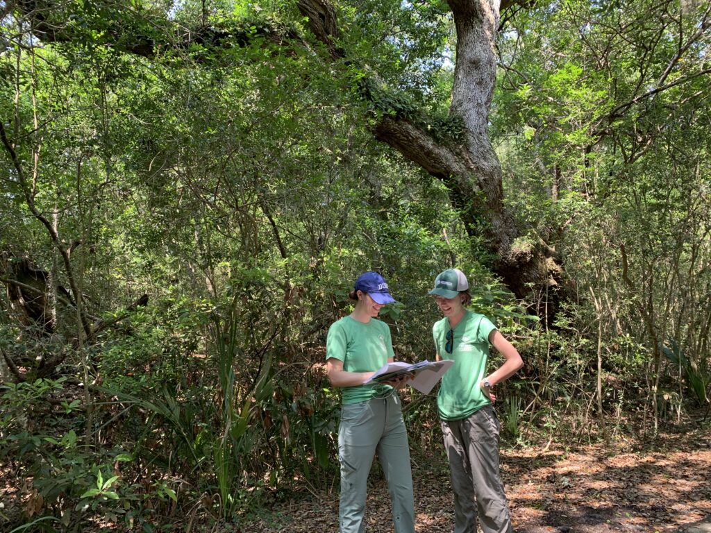
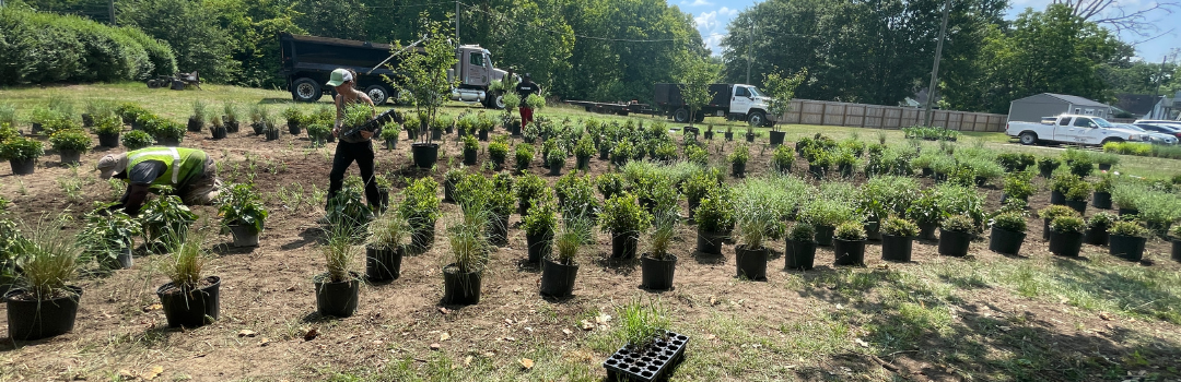
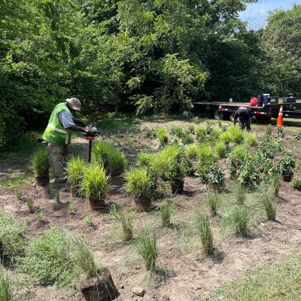
Resilience Corps NC members have built capacity at each of their host sites, whether it be tree planting, organizing volunteer events, community outreach and engagement, land monitoring, environmental education, climate change education, and many other projects designed to seed future resilience.  

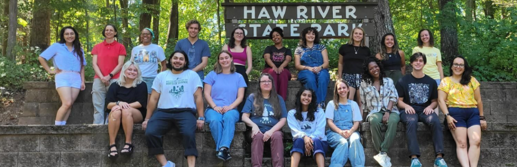
CTNC is proud to champion the movements completed by the Resilience Service Network. Advancing community resilience through building relationships and partnerships is a critical component of all conservation efforts. Having members placed in all regions of the state, Western, Piedmont, Central, Eastern and the Coast, ensures that vulnerable communities are both represented and included in statewide conservation initiatives.  

A Path Towards Regional Flood Resilience Strategies

Rivers have molded the landscape of the entire state, with each river basin different from the other.

As an ecologically diverse state, with landscapes varying from the higher elevation of the western Blue Ridge mountains to the low-lying coastline in the east, within each region, one will experience differing average temperatures, manage different growing seasons for plants and agriculture, and enjoy a wide range of water bodies from lakes to streams, and small to large river networks.

North Carolina is home to roughly 37,853 miles of rivers, plus thousands of tributaries or streams that flow into and feed one of its larger river systems. In total, there are 17 river basins in North Carolina. Because every community falls within one of these basins, every community in North Carolina is impacted by the vast destruction to livelihoods caused by flooding.

We must address flood resiliency from the perspective of a basin-wide approach when recommending conservation solutions to mitigate its effects. 

Since each river basin is contrastingly unique, a one-size-fits-all approach is not applicable when designing strategies to mitigate flooding. The impacts look different by region, demonstrating why a basin-wide level approach is necessary to create manageable, coordinated intervention strategies to improve the flood risk for all communities in North Carolina.  

Understanding River Basins 

A river basin encompasses the area of land drained by a river and its tributaries. Each basin serves as a natural watershed, starting with the rainwater and flow of a central river system that shapes the landscape and ecosystems as the water moves through. River basins influence many concepts of the surrounding area, including local agriculture, urban planning and infrastructure, drinking water, wildlife habitat and diversity and the local economy. Each river basin in North Carolina has its own movement of water from the headwaters to an outfall into the ocean, an estuary, or another river.  

With the 17 river basins in North Carolina, each holds a unique ecological and topographical footprint in response to rainfall events that occurred upstream. Starting with rainfall, water accumulates into a basin that flows into subsequent bodies of water through a stream, river, tributary, groundwater, etc. As water accumulates and moves downstream, the river basin acts as a bathtub, collecting all contents and diverting where necessary.

With more severe climate-change caused weather events, an influx of water to a river basin will cascade into surrounding areas, causing floods.   

The North Carolina Flood Resiliency Blueprint will serve as an online decision-support tool for policymakers, stakeholders and all North Carolinians with the knowledge required to make flood management decisions. The initiative was launched by the NC General Assembly and NC Department of Environmental Quality in collaboration with local and state agencies from across the state. In this process, having stakeholders present from various river basins is crucial to creating a tool that serves all communities and residents of the state.  

As a starting point for proposed flood mitigation action, the Blueprint process will develop basin-wide action strategies for six target river basins: French Broad, Tar-Pamlico, Cape Fear, Neuse, Lumber and White Oak River Basins.

Get to know these focus regions:

French-Broad  

  • Total miles of streams: 3,985 
  • Counties within basin: 8  
  • Size: 2,829 square miles 

CTNC has a deep history of conserving land in Western NC including throughout the French Broad River Basin. CTNC’s Land Protection Director, Rusty Painter, has culminated relationships in communities across this basin through the years to ensure that protected land offers solutions to climate change impacts including flood-related challenges. The Asheville Watershed conservation easement was originally designed to provide a sustainable, clean drinking water source for the City of Asheville, but it also serves as a collection vessel for water flow, helping slow water before it reaches the French Broad river.

CTNC’s Western Conservation Manager, Aaron Flannery, highlights the importance of preserving land to enhance community resilience. “Protecting land in western North Carolina is crucial to the health of NC’s river basins that are fed from waters along the Parkway. Ensuring that the land along the Blue Ridge Parkway is preserved impacts everything that occurs downstream, including water quality, economic development, local and state parks, community resilience and the wildlife that calls the ecosystems of NC home.” 

Tar-Pamlico  

  • Total miles of streams and rivers: 2,521 
  • Counties within basin: 18  
  • Size: 6,148 square miles 

Princeville, NC is no stranger to the impacts of floods from the Tar River, a part of the Tar-Pamlico River Basin. CTNC’s partnership with the Town of Princeville and NC State’s Coastal Dynamics Design Lab inspired the development of CTNC’s Community Resilience Model. This map uses GIS technology to help identify communities at greatest risk to flooding where conservation solutions can provide a community benefit. The NC Flood Resiliency Blueprint will allow the integral flood mitigation work that occurred in Princeville to be utilized at a greater level – within entire river basins. 

Neuse 

  • Total miles of streams and rivers: 3,409 
  • Counties within basin: 18  
  • Size: 6,062 square miles 

Serving as the third largest river basin in North Carolina, protecting the land along the Neuse River Basin is critically important to the cities within the basin by providing drinking water in nine dedicated reservoirs – Falls Lake, Lake Michie, Little River Reservoir, Lake Holt, Lake Orange, New Hillsborough Lake, Corporation Lake, Lake Ben Johnson and Lake Rogers. The basin also holds wetland forests that divert water from flooding nearby communities and captures runoff and rainfall to prevent impacts to downstream communities. For 12 years, CTNC partnered with the City of Raleigh to administer a watershed protection program, The Upper Neuse Clean Water Initiative, designed to raise funds to help land trusts protect land upstream of a rapidly growing region and critically important source of drinking water for the Triangle region.  

Cape Fear 

  • Total miles of streams and rivers: 6,584  
  • Counties within basin: 26  
  • Size: 9,164 square miles 

Lumber 

  • Total miles of streams and rivers: 2,247  
  • Counties within basin: 9  
  • Size: 3,329 square miles 

White Oak  

  • Total miles of streams and rivers: 320  
  • Counties within basin: 6  
  • Size: 1,382 square miles 

Community Expectations 

Protecting these bodies of water is crucial to the flow of water from the mountains to the sea. With the tool created in the Flood Resiliency Blueprint, members of each river basin’s communities can expect to gain a deeper understanding of their floodplain, the history of flooding in that region and the best strategies to combat the impacts of flooding specific to that area. 

Collaboration from all regions of the state is important to ensure that all communities are represented and heard when creating tools like the Flood Resiliency Blueprint. The decisions made upstream in the Western part of the state will impact communities downstream throughout NC. To address the increasing threat of climate-change caused events, like flooding, community and county boundaries will be crossed to foster collaboration in creating effective solutions. CTNC’s relationships with local government organizations, statewide conservation partners and landowners will be prioritized to ensure a holistic approach to flood mitigation strategies occurs in communities across every river basin in North Carolina.  

Navigating Extreme Weather Events: North Carolina’s Flood Resiliency Blueprint 

In response to increasing climate risks, state leaders will deploy tools to help communities impacted by flooding across the state 

In a state that often experiences the unpredictable forces of nature, North Carolina stands at the forefront of climate resilience with the Flood Resiliency Blueprint – an effort launched by the NC General Assembly and the NC Department of Environmental Quality. Representing the largest statewide flood mitigation investment in its history, this initiative is designed with the goal to revolutionize how communities are resourced to respond and recover to climate change-caused disasters. 

Historic flooding events over the years have left many communities across North Carolina in a state of long-term recovery. Day to day, nuisance flooding challenges towns from the mountains to the coast, disrupts the livelihood of North Carolinians. With the increased severity of rainstorms, flash flooding, hurricanes and extreme weather events, action must be taken to ensure that communities can become more resilient to current and future events.  

Serving as an online decision-support tool, the comprehensive statewide flood resilience blueprint will provide policymakers and stakeholders with the knowledge required when making decisions related to flood management. The tool will allow communities to use this resource to understand adaptation and preparedness for extreme weather events.  

The blueprint aims to reduce North Carolina’s annual losses to lives, property and livelihood because of extreme storms and flooding events, and their overall vulnerability. Another goal of this initiative is to decrease the weight of taxpayer dollars used to rebuild infrastructure damaged in said events. The strategic investments to flood resilience planning in specific areas of the state will benefit multiple departments, including water quality, the local economy, the public health system and outdoor recreation.  

Funds allocated to the NC Department of Environmental Quality by the North Carolina General Assembly allowed this initiative to advance, evolving the project to the next step of involving stakeholders in developing the tool. The blueprint is a culmination of collaboration from local and state agencies, along with CTNC, combining shared resources and knowledge to be utilized on one shared platform for all. The primary objective is to empower decision-makers at each level with the tools and strategies required to mitigate flood risks effectively.  

CTNC is proud to be a part of the planning and implementation of this project with the collaboration of other resiliency-driven organizations.

Nuisance flooding is a direct result of a changing climate, where change is needed now more than ever. Combatting the impacts of flooding is an issue CTNC is not new to. In Eastern NC, Princeville, located alongside the Tar River, was hit by Hurricane Matthew in 2016, leaving the town in disarray from flooding. The collaborative partnerships with Princeville after Hurricane Matthew showed that flood resiliency is attainable. The initiative of a statewide action to combat flooding drives CTNC’s goal of fostering community resilience through climate action.  

In response to the flooding events in Edgecomb County, CTNC, in collaboration with NC State’s Coastal Dynamic Design Lab, created the Princeville Floodprint. The goal of this project was to mitigate the impacts of flooding and involve the local community in efforts to strategize and prepare for future flooding events. This project supported state agencies and local leaders to effectively engage in a community resilience framework.  

With the North Carolina Flood Resiliency Blueprint, multiple communities will be offered support like the model created by the Princeville Community Floodprint. Replicating this process on a broader level will allow the project to evolve into a larger, statewide movement with similar seeds of success seen in Princeville.  

As the next steps of the blueprint unfold, the State has identified six river basins to engage more deeply with community and elected leaders to better understand the scope and scale of flood resiliency planning and investments.  

With a clear, unified framework in place, lives and communities will be better prepared and protected from nuisance flooding. North Carolina will serve as the groundwork for the first-of-its-kind flood resiliency program, that could aid other states across the country in preparing for the future of their respective communities.  

CTNC Names New Executive Director

CTNC is proud to welcome Cynthia Satterfield as the new Executive Director of our organization. 

Cynthia joins us with a strong background in community-driven conservation. Her dozen years at the Tar River Land Conservancy as the Director of Development and at the Eno River Association as Director of Development and Outreach ground her in the land conservation work central to CTNC. Her most recent role as State Director of the North Carolina Chapter of the Sierra Club expands her strategic leadership skills. Cynthia holds an English and Anthropology Bachelor’s Degree, Master of Business Administration, Certificate in Non-Profit Management and Equity Training. 

Cynthia’s personal commitment to CTNC’s values of collaboration, boldness, inclusiveness, compassion, authenticity, openness, and curiosity inspired confidence in the CTNC Board.

“Cynthia’s personal commitment to CTNC’s values of collaboration, boldness, inclusiveness, compassion, authenticity, openness, and curiosity inspired confidence in the CTNC Board”, said CTNC Board President Brandon A. Robinson. “We are fully confident that the wealth of experience Cynthia brings will lead CTNC to new growth and new opportunity, making it possible to fulfill our mission of building resilient, just communities by delivering conservation solutions across the state.”

Cynthia will join CTNC officially on December 11th as Chris embarks on his retirement journey. We are excited to begin this new chapter as an organization and enter the new year as a strong-knit group of staff, board members, donors and supporters.

You can help ensure that CTNC enters this new season poised to grow. Your support before the end of the year will seed the next season of growth in conservation for a more resilient North Carolina.

CTNC and Bald Head Island Conservation Partners Collaborate to Build New Prioritization Tool

Climate and Conservation Resilience Data to Drive Future Land Protection on Bald Head Island

The beauty and unique ecology of Bald Head Island needs to be protected. The abundant nesting sea turtle population, vital maritime evergreen forest, and coastal ecosystems need specialized care to ensure they survive for generations. This summer, CTNC and partners on the island teamed up to develop a conservation prioritization tool that will inform how to deploy future work. 

Since 2001, CTNC has collaborated with the Bald Head Island Conservancy and Smith Island Land Trust (SILT) to conserve habitat on Bald Head Island in Brunswick County. CTNC holds 28 conservation easements on Bald Head Island, the southernmost barrier island in the state and a true ecological gem.

The Bald Head Island Conservation Prioritization Tool, developed by Hanna Bliska, a CTNC 2023 Stanback Summer Fellow, is a model that identifies individual properties on the island with the highest conservation value. This will enable Smith Island Land Trust and its partners to focus efforts and limited resources on properties with the most significant conservation impact.

CTNC Summer Fellows Hanna Bliska (left) and Emma Childs (right) visited Bald Head Island in June to ground-truth the results of the prioritization model. 

To make the tool come to life, Hannah collaborated with CTNC Bald Head Island conservation partners and CTNC staff to build the prioritization tool in ArcGIS. This tool is inspired by CTNC’s Blue Ridge Parkway prioritization model that we use to streamline efforts and strategic goals. The plan focuses on protecting undeveloped land on Bald Head Island. The model has incorporated a variety of ecological data, including data on coastal and terrestrial resilience to climate change developed by The Nature Conservancy. 

Undeveloped acreage is critical to both natural and human success on the island. Beyond protecting vital forested and coastal areas, these conserved acres become buffers to soften the impacts of climate change on Bald Head Island. The maps inform SILT’s communications with landowners and educate islanders about conservation opportunities. This will, in turn, ensure a resilient future for the communities that call Bald Head Island home.

The Bald Head Island Conservation Prioritization Tool further demonstrates CTNC’s commitment to creating sustainable programs in collaboration with partners to utilize data-driven approaches to conservation. SILT will maintain the tool to update it as more conservation progress is made on the island. Through partnerships like this, CTNC is helping North Carolina build resilience in the face of climate change.

Thank you to the development team – Hanna Bliska, Rusty Painter, Mary Alice Holley, and Emma Childs. Funding for the project was provided by SILT and Hannah’s time with CTNC was made possible by the Stanback Fellowship Program at the Nicholas School of the Environment at Duke University.

Introducing the 2023-24 Resilience NC Corps Cohort

We’re delighted to welcome the latest cohort of service members with the Resilience Corps NC program. These members, working at placements across North Carolina, are able to fill in areas of need through their host sites that are connected to various diverse communities, building a resilient North Carolina. Their work includes community outreach, environmental education, and environmental stewardship.

Building a resilient community begins with education and the power of knowledge. Having AmeriCorps members within the communities build capacity within and outside their host sites creates a positive impactful domino effect that will be long lasting after their service terms are over.

Here’s where our 2023-24 AmeriCorps members are serving:

Anna Behnke
Conservation Trust for North Carolina
Austin Duncan
Central Pines Regional Council
Christopher Perdomo
Piedmont Environmental Alliance
Cindy Rassi
El Futuro
Eli Haines Eitzen
Eno River Association
Ellen Davis
Central Pines Regional Council
Regina Patton
Balsam Mountain Trust
Grace Sigmon
North Carolina Zoo
Haley Bock
Piedmont Triad Regional Council
Hannah Rhodes
Keep Durham Beautiful
Jessica Blackburn
Highland Cashiers Land Trust
Jordan Pilcher
North Carolina Coastal Land Trust
Lauren Howard
Green River Preserve
Lauren Waibel
North Carolina Coastal Land Trust
Lula Zeray
Meals on Wheels of Durham
Rachel Cohn
Durham Public Schools Hub Farm
Sabrinah Hartsell
North Carolina Zoo
Stephanie Pipas
North Carolina Zoo
Tanya Balaji
Keep Charlotte Beautiful
Tykia Lewis
Town of Princeville

Learn more about Resilience Corps NC and the work being accomplished for communities through service.

Gardens Spring Up Across Princeville

Stormwater interventions offer climate solutions

As communities experience increasingly heavy rainfall, communities across North Carolina are experiencing nuisance flooding. Instances of standing water can disrupt routine day-to-day activities, put added strain on infrastructure systems such as roadways and sewers, and cause minor property damage. 

The town of Princeville knows that well, as do many climate-impacted towns in North Carolina. A spot of historic and devastating flooding as well as every-day challenges resulting from nuisance flooding, this town invested in building natural stormwater capture devices while enhancing once-vacant land throughout the community.

In the summer of 2023, CTNC spearheaded a project to install green infrastructure with wetland enhancement projects on vacant, town-owned parcels along the Tar River. These are now sites where stormwater can naturally flow and reduce nuisance flooding that causes inconveniences to residents, roads, and neighborhoods in populated areas. The project created 6,000 square feet of stormwater retention strategies, including bioretention cells and rain gardens designed to hold 27,740 gallons of water per rain event.

Princeville elected leaders worked with residents and partners to identify three locations throughout town where standing water was already creating safety hazards following large rain events. By turning these sites into managed wetland areas with trees, shrubs, and pollinator plants, each site can now absorb stormwater and address standing water issues. This is all while beautifying each plot with seasonal colorful blooms and leaves, supporting native wildlife, including birds and other pollinators.

GARDENS ARE READY TO BLOOM

Site 1 is located at Town Hall and Freedom Hill to help add stormwater runoff at a high-traffic intersection of Princeville. The site includes NC native pollinator plants including Soft Rush, Walker’s Low Catmint, and Black-eyed Susan.

Site 2 is located at the corner of Church and Walston Streets, and Site 3 is located at the corner of Beasley and Walston Streets. These locations were selected due to their proximity to the elementary school rain garden installations completed in 2020.

The project is continuing with an important science component. The Town of Princeville seeks to incorporate community education into every conservation project that takes place. In the case of the stormwater infrastructure improvements, CTNC received funding from TELUS to purchase sensors that track the water absorption rate of the wetland areas. These sensors are offered by Temboo, a technology company that utilizes data to engage communities in understanding their environmental impact locally. The sensors will be installed this summer and will collect data that will be shared with town leaders, educators, students and families to showcase the importance of conservation as a natural solution to flooding and other climate-related issues being experienced by Princeville and surrounding communities.

RAIN GARDENS & WETLAND ENHANCEMENTS OFFER A CLIMATE SOLUTION

Communities across North Carolina are experiencing greater occurrences of precipitation and rain events that cause minor and major flooding. Conservation solutions, like installing rain gardens and other stormwater management techniques, are a great way to manage flood water while benefiting communities and residents. These types of installations are beautiful, offer a benefit to wildlife like birds and pollinators, effectively manage stormwater, naturally filter contaminants from water flow before it reaches a river or stream, and are low maintenance options for long-term care. CTNC supports natural solutions like stormwater infrastructure to benefit communities seeking to build resilience to flood challenges exacerbated by our changing climate.

The stormwater designs and plant selections were created by NC State Coastal Dynamics Design Lab based on recommendations from the Princeville Community Floodprint. It was informed by input from Princeville residents and approved by the Town of Princeville Board of Commissioners. The project will be installed by M&M Landscaping – a local contracting partner participating in the conservation projects being funded through CTNC.

Funding for this project was generously provided by the Commission for Environmental Cooperation EJ4Climate grant.

Building Upon Our Successes

North Carolinians love the outdoors. Visitation to NC State Parks increased to 22,800,000
in 2021 – 3,000,000 more than in 2020. Visitation to state forests, game lands, trails and
local parks continues to increase.

The Land for Tomorrow Coalition greatly appreciates the strong support of the General
Assembly and Governor for our Conservation Trust Funds and looks forward to working
with them in 2023 to build upon our success. Land for Tomorrow recommends the
following to the 2023 General Assembly.

NC Land and Water Fund
Increase recurring funds to:

  • $30,000,000 recurring
  • $20,000,000 in non-recurring funds in FY 23-24

The Land for Tomorrow Coalition strongly supports continuing NC Land and Water Fund’s
flood risk reduction grant program.

  • $15,000,000 to continue NCLWF’s flood risk reduction program

Parks and Recreation Trust Fund

  • $30,000,000 recurring
  • $20,000,000 in non-recurring funds in FY 23-24

Agricultural Development & Farmland Preservation Trust Fund

  • $15,000,000 recurring as recommended by Agriculture Commissioner Steve Troxler

Great Trails State Funding
The Land for Tomorrow Coalition supports the Great Trails State Coalition’s request for
appropriations to establish the Great Trails State Fund.

Dedicated Funding and Conservation Tax Credit
The Land for Tomorrow Coalition supports restoring dedicated funding from state deed
excise stamp tax revenues to the Land & Water Fund and Parks & Recreation Trust Fund
and restoring the 25% conservation income tax credit.

Stewardship of State Lands, Facilities & Funds
The Land for Tomorrow Coalition strongly supports requests by the Department of
Natural & Cultural Resources, NC Wildlife Resources Commission and Department of
Agriculture for staff to manage the conservation trust funds and to manage new state
parks, historic sites, game lands and state forests.

New Tools Help North Carolina Orgs Set Land Conservation Priorities Amid Climate Change

Conservation Trust for North Carolina and Nicholas Institute designed the tools to evaluate the benefits of natural and working lands to climate resilience, adaptation and mitigation

Conservation organizations and land trusts in North Carolina increasingly view their mission to protect the state’s natural lands through the lens of climate change.

A new pair of online tools aims to help them more efficiently consider how their work could contribute to climate resilience, adaptation and mitigation, as well as deliver other conservation benefits. The tools were created jointly by the Conservation Trust for North Carolina and Duke University’s Nicholas Institute for Energy, Environment & Sustainability.

“North Carolina’s natural and working lands are critical to making our communities and ecosystems more resilient to climate change in the decades to come,” said Katie Warnell, a senior policy associate at the Nicholas Institute who co-led the project. “These tools will help inform decision-making processes for conservation organizations and land trusts by making the best publicly available data on these lands easily accessible without the need for advanced geospatial expertise.”

Natural and working lands—such as forests, farms and wetlands—cover more than 80 percent of North Carolina. They protect water quality and supply, reduce flood risk for communities, provide habitat for pollinators, and much more. These lands—particularly forests—also store carbon in their soils and vegetation, helping to offset greenhouse gas emissions that cause climate change.

The two tools deliver complementary information to organizations looking to preserve new lands, better manage lands they already own or demonstrate their value:

  • The high-level conservation prioritization tool enables users to identify broad areas for conservation action, either within the entire state or by county, river basin or a defined region. The tool prioritizes sub-watersheds with the greatest potential to meet a set of up to 11 conservation metrics selected by the user.
  • The benefits calculator estimates conservation benefits for specific areas of interest, such as individual properties. Organizations could use this information to communicate the benefits provided by currently conserved properties or to support decisions about conserving new areas.

“Land conservation provides so many overlapping benefits to communities,” noted Chris Canfield, executive director of CTNC, “yet documenting and sharing these can be difficult for many organizations. Input from nonprofit and government conservationists has driven this effort to tell a more complete story of our work together.”

The tools use many of the same data sources as recent state planning efforts recognizing the importance of natural and working lands. Those plans include the 2020 Natural and Working Lands Action Plan (part of the NC Climate Risk Assessment and Resilience Plan) and the Coastal Habitat Protection Plan 2021 Amendment. Collectively, the plans are helping to quantify the benefits that North Carolinians currently get from natural and working lands. They also explore additional benefits that could be gained through management actions, such as reforestation or agricultural best management practices.

The tools are also part of a growing set of resources from the Nicholas Institute related to natural and working lands in North Carolina. Launched in January 2022, three online dashboards map the benefits of these lands, making detailed data easily accessible to communities, land managers, non-governmental organizations, and the general public. The dashboards allow users to quickly see these benefits by county, river basin or land type:

  • Overview Dashboard – General information about the area and benefits of natural and working lands
  • Conservation Dashboard – Focus on natural and working lands that are protected for conservation purposes
  • Carbon Dashboard – Details about past, current, and potential carbon storage by land type

The NC Conservation Prioritization Tool and NC Conservation Benefits Calculator were designed by recent Duke University graduate Israel Golden, who holds dual master’s degrees in environmental management and forestry from the Nicholas School of the Environment. Support was provided by Open Space Institute and the Land Trust Alliance.

Reposted with permission from the Nicholas Institute

Climate Resilience Leaders – Rusty Painter

Photo of Staff Member Rusty Painter

Rusty Painter’s Master of Environmental Management from the Nicholas School of the Environment at Duke University wasn’t the end of his connection to the school and the future of climate protection. He returns each year to present to classes on a variety of topics, from CTNC’s strategic approach to address climate change and more. “I’m motivated by my son and future generations, from whom we are all ‘borrowing’ this planet.”

His background and his master’s degree in forestry are invaluable as Land Protection Director for CTNC. Rusty joined the CTNC family in 2001. He oversees CTNC’s land protection efforts along the Blue Ridge Parkway and our collaborative partnerships with local land trusts. Recent successes include the preservation of the Florence Boyd Home / Asutsi Trailhead Property, and the Cranberry Creek Expansion project, both of which will be transferred to the Blue Ridge Parkway.

Rusty Painter tours the Florence Boyd/Asutsi Trailhead property with Blue Ridge Parkway Superintendent Swartout, Chloe Ochocki, & Caitlin Markus (L to R).

When did you first realize the real and present impacts of climate change?
The concept of global warming due to the greenhouse effect made sense to me the first time I heard about it, but I guess I really grasped the severity of the problem when Al Gore’s book An Inconvenient Truth came out. What a shame that our political, social and economic systems continued to drive us down this path. Think how much progress could have been made over the last 30 years had we committed to solving the problem back then.

What does climate resilience mean to you?
Adaptation using a combination of evolution and technology – applying our experience, and projections based on sound science to adapt to our changing climate. We must realize that adaptation isn’t the only path forward. Humans must commit themselves to actions that will minimize the need to adapt, or the extent to which we must adapt.

How have you seen climate change impact North Carolina?
One example that I struggle with in my work at CTNC is the expansion of tick habitat. I never used to get ticks while visiting our conservation properties along the Blue Ridge Parkway, but climatic shifts have enabled ticks to colonize areas that were previously too cold, so I’m now getting ticks while out on properties in the mountains. Yuck!

What are actions that organizations in NC can take right now to make our state more resilient?
Conserve energy. Simply using less results in immediate reductions of carbon emissions and has the potential to save far more resources (of all kinds) than our slow, incremental conversion to renewable energy sources. I challenge everyone to consider every action they take throughout the day and do it with half of what they currently use. You’ll find it’s not as difficult as you think. That approach can be applied to most organizations, corporations and government agencies as well. Once ingrained in our psyche, daily routines, organizational procedures, and subsequently, our infrastructure, carbon neutrality on a timeline that will make a difference becomes legitimately achievable.

What’s one thing everyone should know about climate action?
It’s up to all of us to change our mindset and daily routines, but also to support groups doing good work, and electing leaders committed to making the difficult decisions & changes we must make.

Working in climate resilience can be overwhelming. How do you keep going?
I remain optimistic because of the resilience of the human spirit and advancements in technology. Organisms change and adapt…daily, yearly, and over generations. Humans have evolved to the point where we can adapt naturally, like other species, but also use technology to ‘artificially’ adapt. I just hope society is willing to change sooner rather than later, so future generations don’t have to rely on artificial adaptations that will diminish our connection to the natural world.

If you have questions about how CTNC’s land protection enhances climate resilience, contact Rusty to start a conversation.

Categories