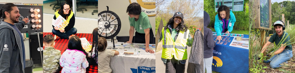
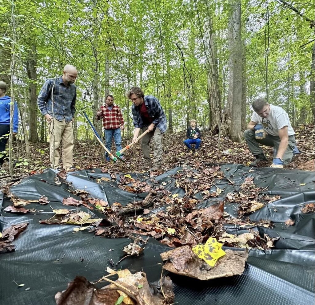
With CTNC’s Resilience Corps NC AmeriCorps program, building capacity is more attainable. The placement of members directly contributes to the current and future projects that nonprofits and local government/agency partners involved in the program hold to benefit North Carolina.
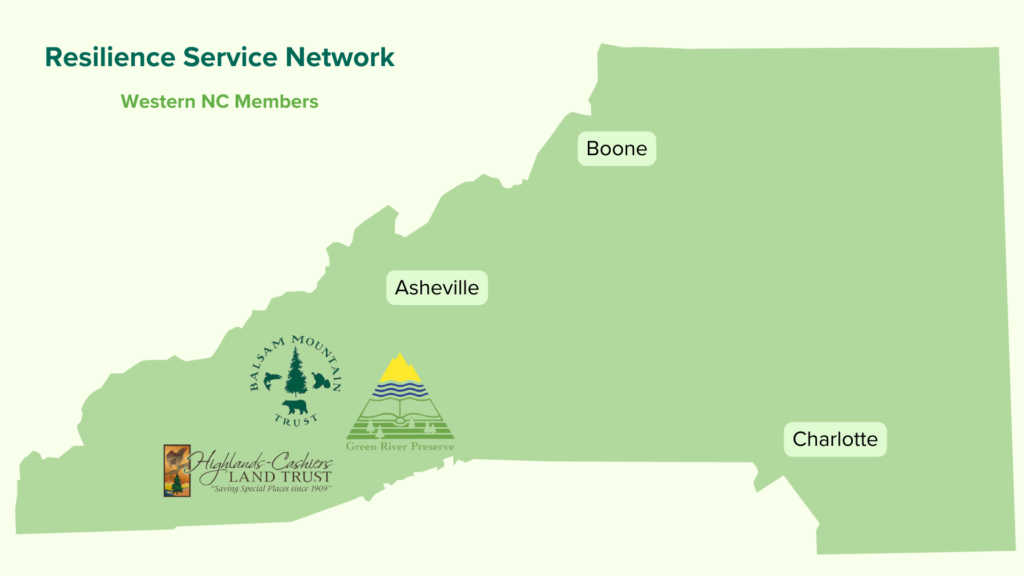
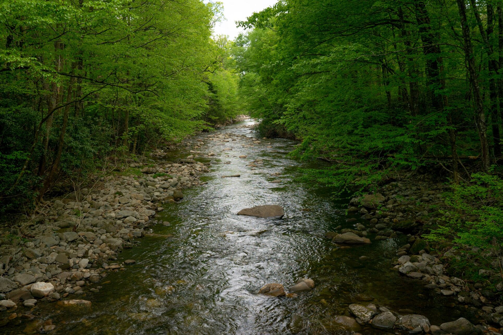
Evidence of Resilience in the Blue Ridge Mountains
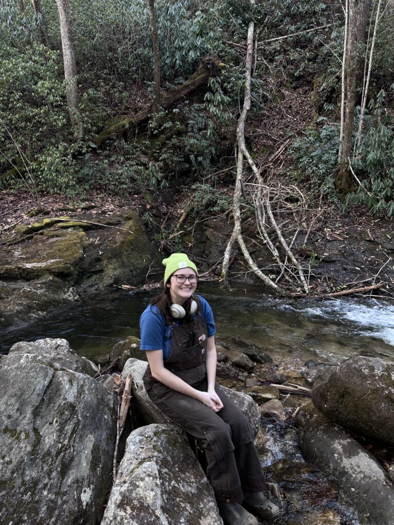
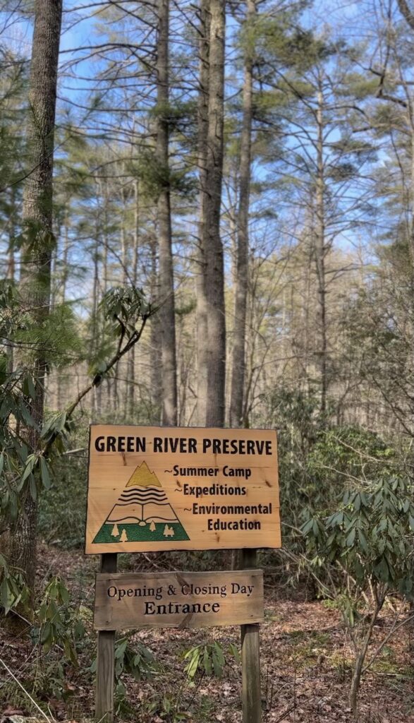
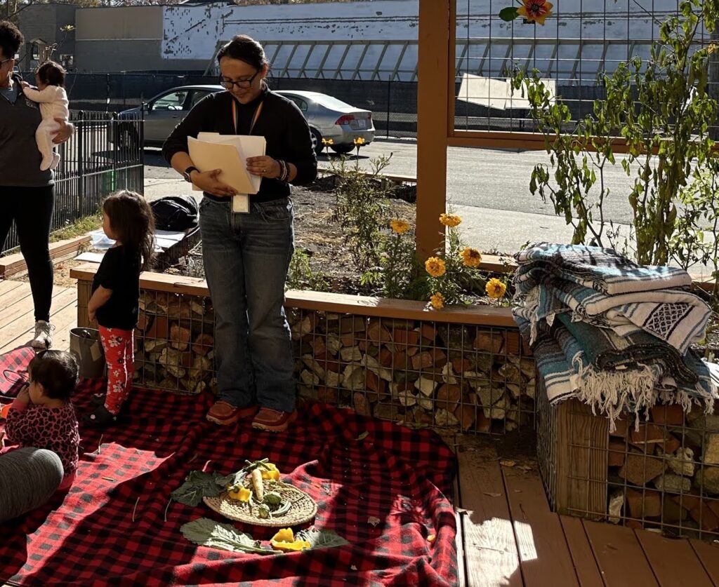
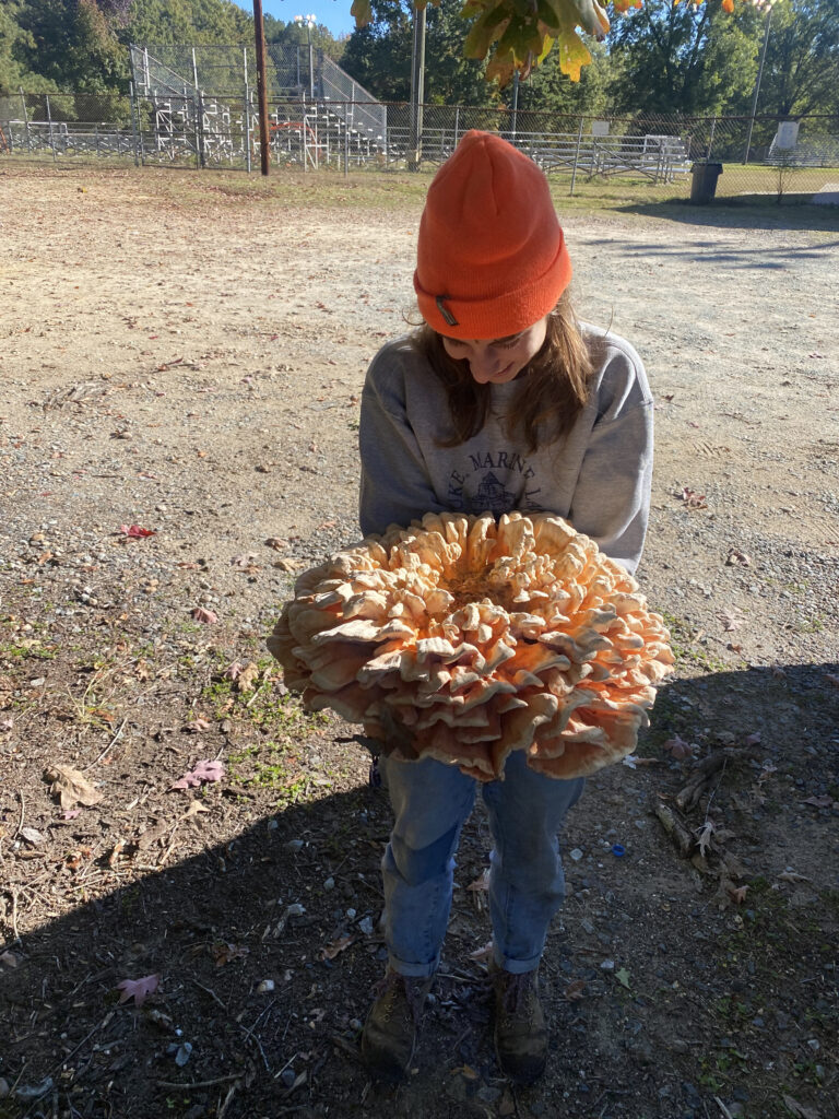
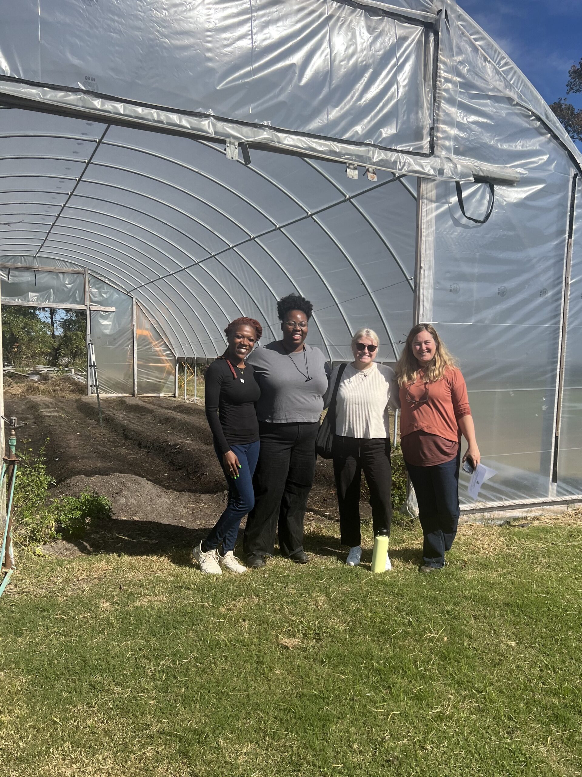
Lauren Howard serves as an Environmental Educator at Green River Preserve. Green River Preserve is nearly 4000 acres of protected land in Cedar Mountain, NC that is home to a summer camp and field trip site. Lauren grew up attending summer camps at Green River Preserve and was also a camp counselor while she was completing her undergraduate degree.
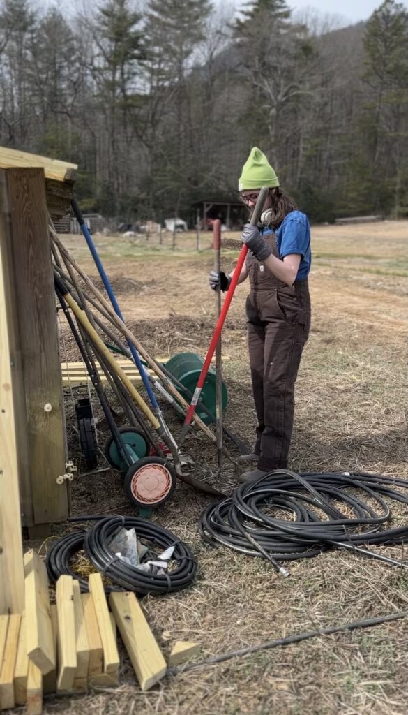
Lauren is proud to serve as GRP’s AmeriCorps member to educate children and assist farm tasks on the property, especially since she has a previous connection to the organization. Lauren focuses most of her time on the KALE Program, Kid’s Agricultural Learning Experience, updating the curriculum and creating environmental education-themed activities to immerse students in the natural world. The program allows children to have hands-on experience in learning about agricultural practices, environmental conservation and an introduction to the diverse ecology of Western North Carolina.
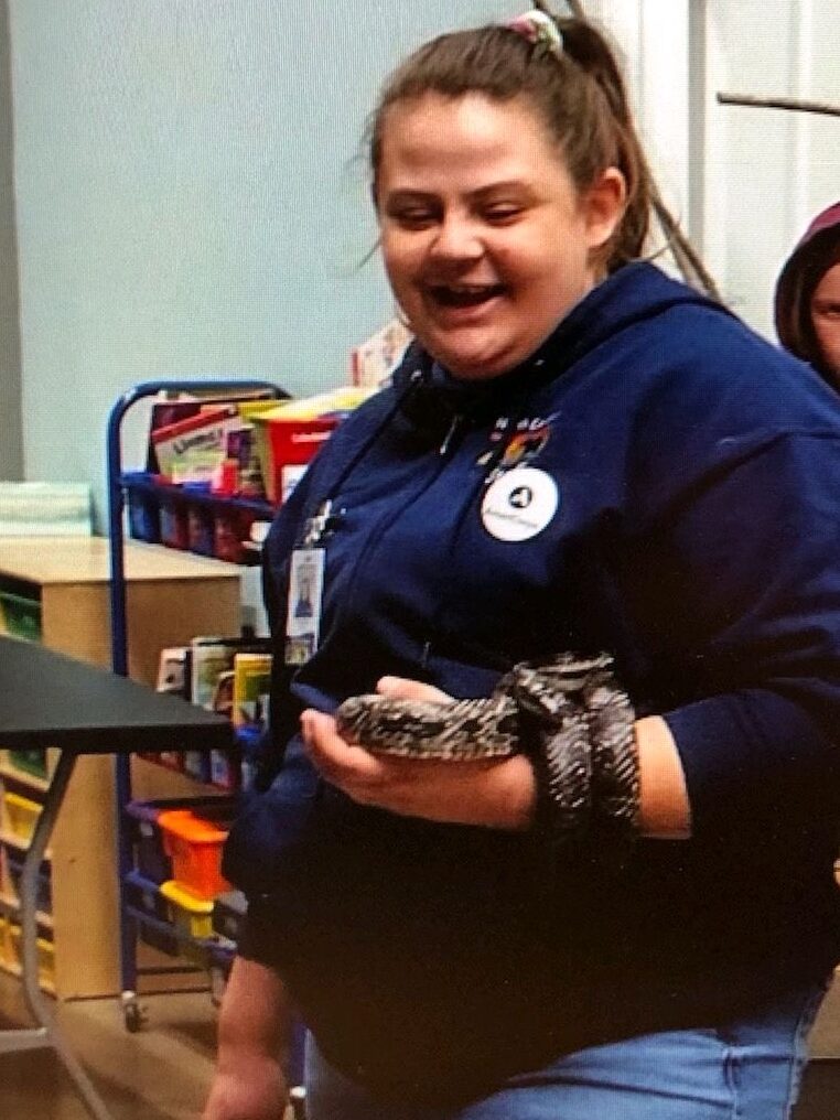
Gina Patton serves as the Education Outreach Coordinator for Balsam Mountain Trust in Sylva, NC, where she oversees public-facing environmental education programs. Balsam Mountain Trust is a part of Balsam Mountain Preserve, a private residential area in the Blue Ridge Mountains. Balsam Mountain Trust aims to create environmental stewards with a focus on preserving the ecology found among the Blue Ridge Mountains.
Throughout her service year, Gina has achieved significant milestones, including recruiting and supervising an animal care volunteer and delivering various educational initiatives such as the Adopt-A-School program and ecoEXPLORE programs to Title One schools and county libraries.
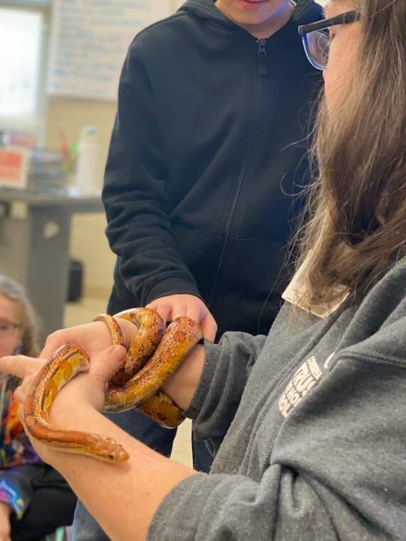
She has also conducted interpretive hikes and hosted school field trips, showcasing her dedication to environmental education. Currently, Gina is focused on planning the 7th annual Bird Festival to celebrate World Migratory Bird Day. Gina enjoys leading interpretive hikes at the local public park to educate the public on the local wildlife. A highlight of her role includes engaging children in hands-on experiences, as depicted in the attached image where she is seen allowing kids to interact with Orville, the corn snake, during an Adopt-A-School program.
Gina with fellow Resilience Corps NC member, Charlie Robinette, during a member shadowing experience.
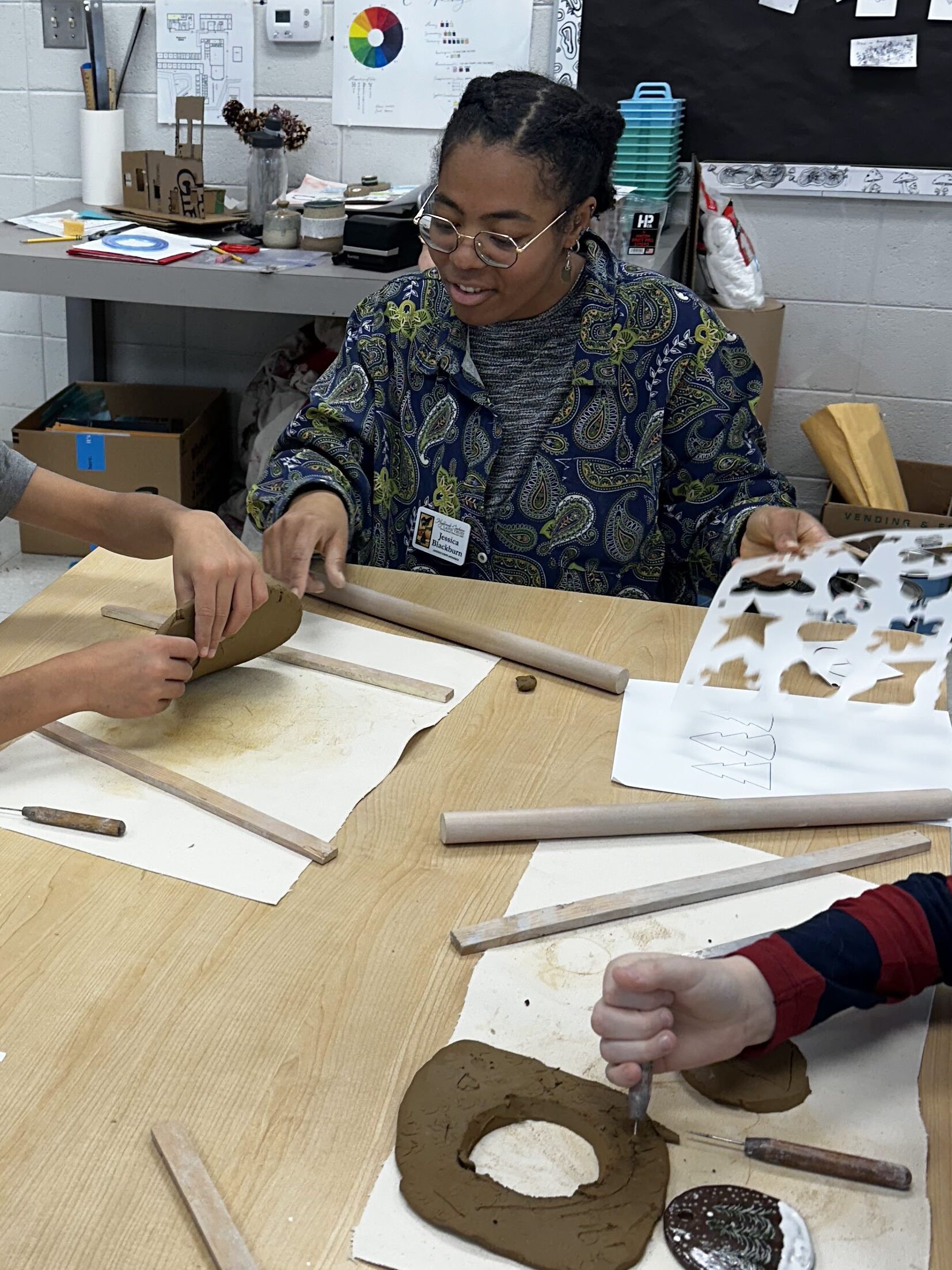
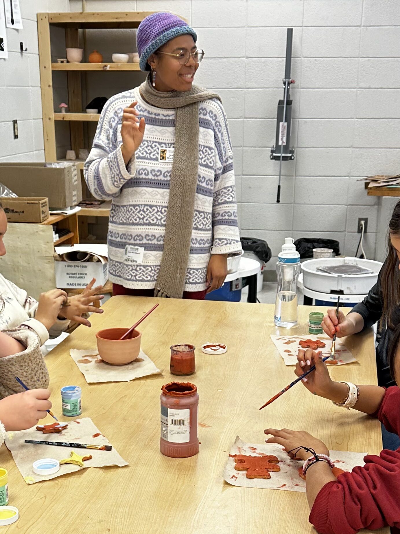
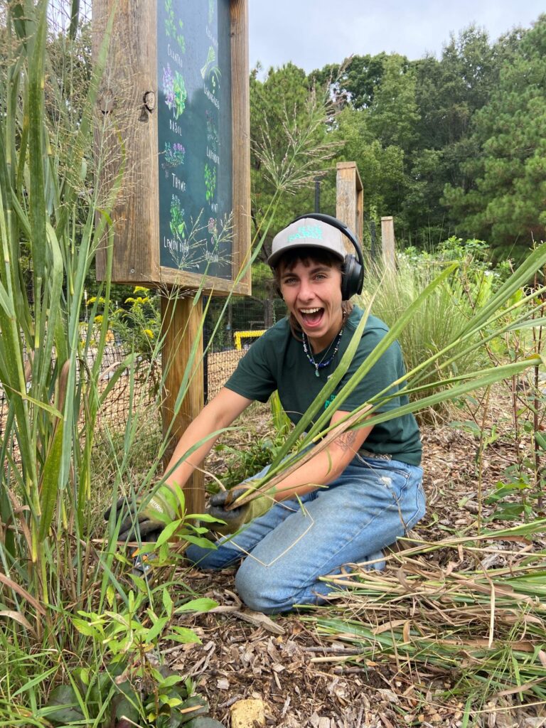
Jessica Blackburn serves as an Environment Educator at Highlands-Cashiers Land Trust (HCLT) in Highlands, NC. HCLT focuses on preserving the Soutern Appalachians through the conservation of wetlands, forests and vistas. At HCLT, Jessica plays a pivotal role in organizing and planning after-school programs, coordinating community events, managing social media, and fostering connections with local schools and community members.
Jessica has assisted in waterway preservation through her collaboration with Environmental Quality Institute (EQI) in Asheville to collect water samples at HCLT’s public access property, Brushy Face. Once more cumulative data has been analyzed, Jessica plans to hold community events for locals to get educated on the health of their streams.
Additionally, Jessica has facilitated pottery programs in partnership with a local K-12 school to have pottery programs that educate students on how the Cherokee people have used and use clay to make functional pottery.
She has also pursued personal development opportunities by completing a chainsaw course and making progress toward an environmental educator certificate. Currently, Jessica is spearheading two major projects—a bioblitz and a partial eclipse watch party—and has committed to staying for a second term with Resilience Corps NC at HCLT to see through her ongoing projects.
The Future of Resilience in Western North Carolina
Western North Carolina is a large asset of what makes North Carolina so enchanting and ecologically diverse. Protecting the land along and past the Blue Ridge Parkway is crucial to ensuring that future generations can view the vast landscapes of the Blue Ridge Mountains. Through the service of AmeriCorps members that build capacity at the local community level, active progress is being made towards prioritizing conservation and education in Western NC.
Through CTNC’s Resilience Corps NC AmeriCorps program, building capacity is more attainable. The placement of members directly contributes to the current and future projects of our conservation nonprofits and local government agency partners to benefit North Carolina.
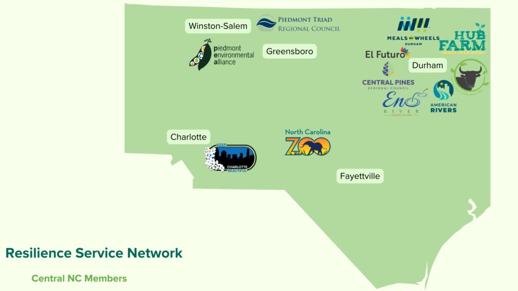
Members Building Capacity in Central North Carolina
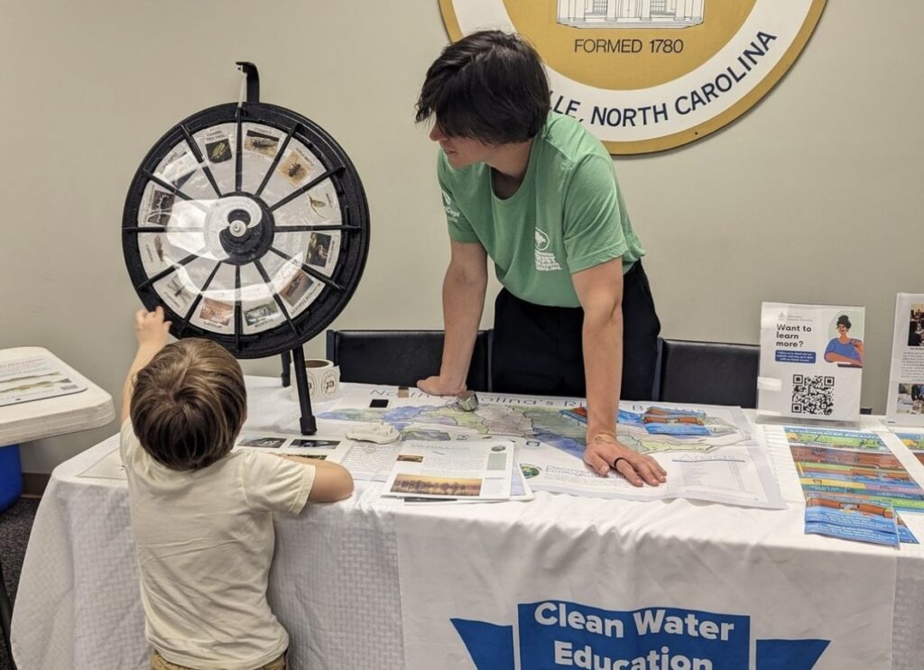
Austin Duncan is serving as the Stormwater Education Coordinator for Central Pines Regional Councill. Austin has made significant strides in community outreach and environmental education, having reached over 1700 individuals across 16 different communities through direct educational efforts. As a participant in the NC Stream Watch Ambassadors Cohort, he has begun integrating its curriculum into his teaching plans. Austin has spearheaded the planning efforts for Regional Creek Week 2024, a weeklong series of events aimed at fostering connections between communities and their local waterways. One of the highlights of the regional event is the Wandering Water Map, a live photo map where participants can share their significant bodies of water.
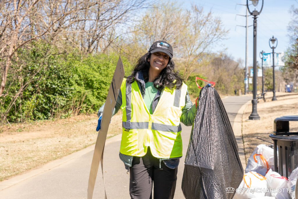
Tanya Balaji is the AmeriCorps Engagement and Education Specialist for Keep Charlotte Beautiful, a city program offering waste reduction, litter prevention, and community beautification/greening projects and services for residents in Charlotte, North Carolina. As an AmeriCorps member, Tanya conducts outreach to various stakeholders in the community, with a focus on engaging with underserved and non-traditional communities. Some programs she focuses on are promoting and improving are as follows: Adopt-a-City-Street program, Adopt-a-Bus-Stop program, Corridors of Opportunity cleanups, Bee City events, America Recycles Day events, environmental education programming for elementary school students, and so much more!
As an individual with a passion for research and development, Tanya’s main project at KCB is currently helping the City of Charlotte pilot a litter study, in partnership with UNC Charlotte. The goal for this study is to analyze the composition and distribution of litter across the City, with the goal of using the data to determine what actions we can take to create a more sustainable future in Charlotte. This project will sample 381 road segments across the City and will take place with the help of volunteers. The study launches on April 1st, 2024, and will continue until January 2025.
Amongst organizing other regular programming events such as organizing litter cleanups and Bee City events to celebrate pollinators, Tanya is currently in the process of helping a local Title 1 elementary school create a beautification project to bring the community together, as part of the Great American Cleanup, a national initiative to beautify the environment and bring awareness to environmental stewardship.
For the remainder of her service term, Tanya is excited to continue growing the program and conducting outreach to underserved communities. She’s also hoping to spend more time engaging with the younger generation, to help shape them into environmental stewards who care for both their community and environment.
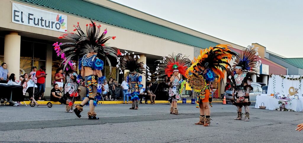
Cindy Rassi serves as the Community Engagement and Therapeutic Green Space Coordinator for El Futuro. El Futuro provides support and services to the Latino community in North Carolina. The presence of green spaces is known to boost mental health, encouraging the need for these areas in the El Futuro property. Cindy’s initiative to enhance these areas allows for the community to gain a deeper connection and understanding to the natural world and conservation for our environment.
Cindy has achieved remarkable milestones during her service year, notably by boosting participation and programming, resulting in the doubling of participants and forging new collaborations with community agencies. Cindy is engaged in coordinating several upcoming events at her host site, including “Sembremos Juntos” (during Creek Week), “Un Dia a la Vez” (one day at a time), Niñitos de la Naturaleza (parent-child group-exposing kids to nature) and an Earth Day celebration for the community. Additionally, Cindy is conducting a Green Space Survey in the community. She is particularly intrigued about exploring the impact of Therapeutic Green Space on the mental health of the Latino community and crafting events and programs that address the community’s needs based on their input.
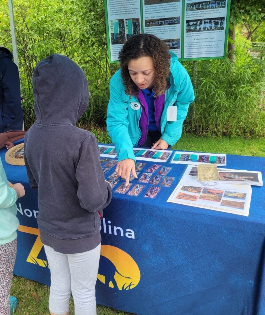
Sabrinah Hartsell is a senior member of Resilience Corps NC, with this service year being her second year serving at the North Carolina Zoo. Sabrinah is the Nature Rock’s, the NC Zoo’s afterschool programming, & Virtual Programming Assistant with a focus on serving those who are historically undeserved. Sabrinah provides nature connection, climate change, and STEM career programs for about 450 children.
Through collaborations with the Museum of Art, We Thrive Together, and other local organizations, Sabrinah assists in providing accessible programming to adults with developmental and vision disabilities.
Another role of Sabrinah’s is to help manage the North Carolina Zoo’s educational Facebook group called “Adventures in EdZOOcation”. With this page, she develops content for the group, coordinates with the Zoo’s communications team about the analytics of the group and determines how they use the group to educate online participants. Sabrinah is very passionate about the collaborative work she does with these communities and is very proud of how far the programs have come.
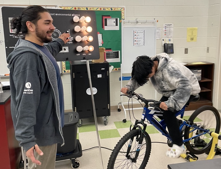
Serving as an Enviornmental Educator at the Piedmont Environmental Alliance (PEA), Christopher coordinates scheduling for Education Programs, engages in community event tabling, recruits and manages volunteers, and teaches 7th and 9th-grade students about Energy and Water conservation. Noteworthy accomplishments during his service year include educating over 2000 Title 1 students on water and energy conservation. Christopher also organized an Environmental Debate Tournament for high school students involving 93 participants from 12 different schools across three counties.
Christopher is focused on organizing the Environmental Debate Tournament Finals as part of PEA’s Free Earth Day Fair celebration. He finds great excitement in regularly visiting classrooms and witnessing the students’ enthusiasm for science class, making it a highlight of his service year.
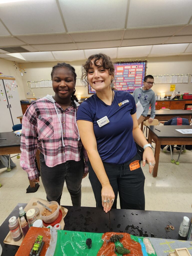
Haley Bock is a senior member of Resilience Corps NC and is serving her second year of service at the Piedmont Triad Regional Council (PTRC) as an Environmental Educator. Haley plays a crucial role in implementing environmental science programs at Title 1 schools, covering topics such as soil and water conservation, freshwater ecosystems, and the water cycle.
Throughout the service year, Haley has made significant achievements, having educated over 2,300 individuals through stormwater education initiatives and nearly completing her Environmental Educator Certification.
Currently, her focus is on forming an environmental committee to promote sustainable practices within the PTRC office, organizing Creek Week programs, and scheduling summer reading programs. She eagerly anticipates receiving her Environmental Educator Certificate, marking a milestone in her service year journey.
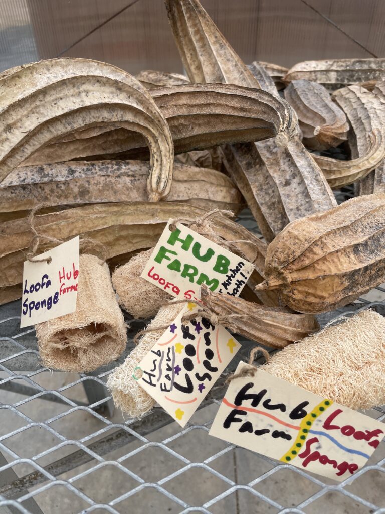
Rae serves as an Environmental Educator focused on K-12 field trips, internships, and summer camps at the Durham Public Schools Hub Farm. Rae is also a steward of the Hub Farm’s 30-acre property, which includes a garden, orchard, wetland and forest habitats, with chickens, rabbits, an apiary, farm cat, and plenty of wildlife.
Rae also facilitates several community collaborations including a tri-yearly plant giveaway for school and community gardens in Durham (UCAN, El Futuro, etc.), the Farm to School initiative with the Durham County department of Public Health, a collaboration with the Latin American Consortium of Duke/UNC, and a collaboration with the Resilience Curriculum project at Duke/NCSU.
Rae has developed several programs and collaborations in a way that the Hub Farm did not have capacity for before, including developing curriculum and programming for field trips (resilience curriculum, soil testing, water quality, shad in the classroom), new and increased community partnerships (an afterschool program at Eno Valley Elementary, 4H club with NC State Cooperative Extension, and partnerships with UCAN, El Futuro, F2S, LAGC), and stewarding our non-human community with new seed solicitations, culturally relevant heirloom crops (indigenous foods, and geography themed beds for LAGC and African-American foodways), a new vermicomposting system, bunny ramps, mobile chicken coop, and fish aquaculture capacity.
Rae is also undergoing a fisheries restoration project with the NC Museum of Natural History called “Shad in the Classroom”, where they rear juvenile fish larvae to release in the Neuse River and is hosting a fishing event at the end of April to celebrate aquatic foods. Rae is excited to use these resources to support their local community’s growth, both through food and environmental education as well as physical garden resources.
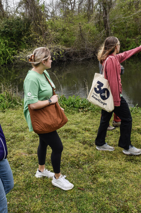
Anna is serving as the Communications & Outreach Associate for Conservation Trust for North Carolina. Anna plays a collaborative role as both a Resilience Corps NC member and working closely with CTNC staff on communications needs and outreach measures.
Throughout her service term, Anna has travelled throughout the state to meet with fellow Resilience Corps NC members. During these trips, Anna learns more about each member’s role and gathers content to share with CTNC’s supporters and beyond. Anna also assists in creating the content for CTNC’s blogs, website, emails and social media platforms.
From the mountains to the coast, Anna enjoys travelling to display the diverse service contributions from the members in her cohort and the climate resilience work of CTNC. She has visited with Lauren Waibel from NC Coastal Land Trust, Tykia Lewis from the Town of Princeville, Lauren Howard from Green River Preserve, Tanya Balaji from Keep Charlotte Beautiful, Hannah Nystrom from Cape Fear River Watch and Rae Cohn from The Hub Farm so far.
Communicating the interworking of Resilience Corps NC is crucial to show others the monumental strides in community resilience that occur from the presence of AmeriCorps member placements.
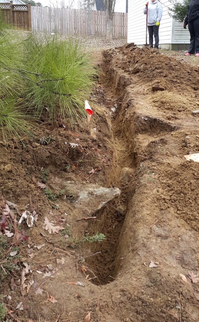
Ellen Davis is serving as a Community Development AmeriCorps Member at the Central Pines Regional Council. Ellen is actively involved in assisting low-income homeowners within Wake, Durham, Orange, Chatham, Lee, Moore, and Johnston Counties. Her role within the Housing Focus Area entails connecting homeowners with repair resources, conducting research on housing-related topics, and administering housing grant funding.
Throughout her service year, Ellen has contributed to streamlining and standardizing home repair processes, facilitating quicker service delivery to homeowners. She has also successfully connected applicants with various resources to address diverse needs, including temporary space heaters, grants for children with autism, and domestic violence support groups.
Currently, Ellen is managing six different projects aimed at serving approximately 70 homeowners across four counties, with repair costs ranging from $8,000 to $40,000. One of the most rewarding aspects of her service is witnessing the positive impact of completed repair projects on homeowners’ physical and mental well-being. Ellen finds joy in seeing “After” photos of completed projects, signifying tangible improvements in people’s lives.
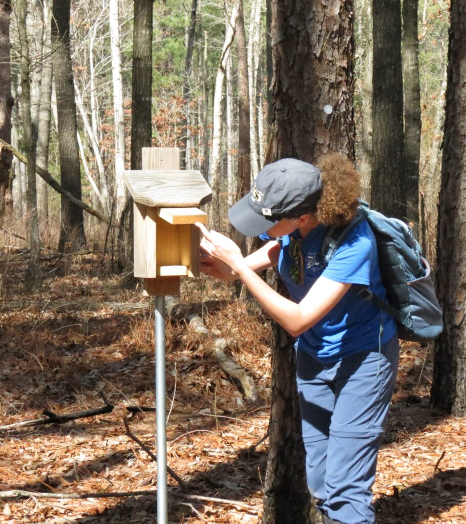
Grace is a senior member of Resilience Corps NC and is in progress of her second service year at the North Carolina Zoo. Grace serves as the Natural Areas Conservation Educator, where she educates the public on the biodiversity of North Carolina. Her endeavors include leading guided hikes for local groups in Asheboro, conducting environmental education programs for after-school groups, and participating in wildlife surveys at the Zoo.
Additionally, Grace contributes to trail and land management projects at the NC Zoo-owned nature preserves. Grace collaborates with NC Zoo staff on citizen science projects such as NestWatch observations and NC Bird Atlas observations, aiming to involve colleagues in conservation efforts and ensure project continuity beyond her service year.
Grace also assists her supervisor in monitoring salamanders during the breeding season at offsite properties, contributing to species identification and population baseline data. She is passionate about leading guided hikes for after-school groups, partnering with fellow AmeriCorps member Sabrinah Hartsell to offer outdoor experiences to children from the Dream Center after-school program. Grace finds joy in witnessing the children’s enthusiasm for exploring nature trails and eagerly anticipates hosting their group again for future trail programs.
Eli serves as the AmeriCorps Education Program Coordinator at Eno River Association in Durham, NC. Throughout his service year, Eli has developed and implemented over 10 monthly place-based environmental education programs for Title I public schools, private groups, and the general public. Eli has also expanded partnerships and service learning opportunities with other local nonprofits, particularly with Urban Community AgriNomics (UCAN).
Currently, Eli is focused on continuing to develop and lead new programs in schools, preparing for two youth environmental education summer camps. Eli is also assisting in the planning and preparation of the Festival for the Eno, scheduled for July. Additionally, Eli is establishing a citizen science monitoring program to engage volunteers in data collection and inform the Eno River Association’s land management practices. Eli is most excited about participating in EnoFest this year and engaging in all the summer camp activities.
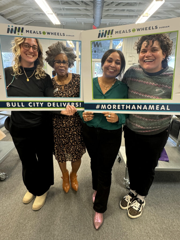
Lula is serving her second AmeriCorps year with Meals on Wheels Durham as the Volunteer Services Associate. Throughout the service year, Lula has achieved significant accomplishments in building the capacity of the volunteer program at Meals on Wheels Durham. Lula created the first ever volunteer satisfaction survey, crafted helpful volunteer training videos, developed a new tracking system for recruitment, and collaborated on the strategic planning process of the volunteer program. Lula also created two comprehensive volunteer programs, with one focusing on leadership development opportunity for volunteers and another program to assist in route coverages.
Currently, Lula is actively involved in implementing the two volunteer programs and is in the process of developing two additional leadership opportunities for volunteers seeking to enhance their professional and personal skills.
The Future of Resilience in Central North Carolina
As members contribute to building community resilience, the projects of Resilience Corps NC in Central North Carolina will persist and develop through the years to come. The path to a more resilient North Carolina is achieved through enhancing the capacity of communities at a local level.
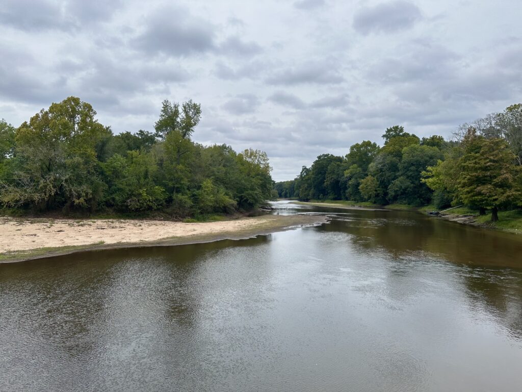
Rivers have molded the landscape of the entire state, with each river basin different from the other.
As an ecologically diverse state, with landscapes varying from the higher elevation of the western Blue Ridge mountains to the low-lying coastline in the east, within each region, one will experience differing average temperatures, manage different growing seasons for plants and agriculture, and enjoy a wide range of water bodies from lakes to streams, and small to large river networks.
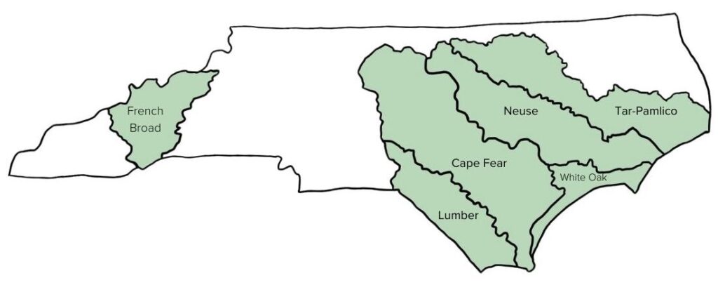
North Carolina is home to roughly 37,853 miles of rivers, plus thousands of tributaries or streams that flow into and feed one of its larger river systems. In total, there are 17 river basins in North Carolina. Because every community falls within one of these basins, every community in North Carolina is impacted by the vast destruction to livelihoods caused by flooding.
We must address flood resiliency from the perspective of a basin-wide approach when recommending conservation solutions to mitigate its effects.
Since each river basin is contrastingly unique, a one-size-fits-all approach is not applicable when designing strategies to mitigate flooding. The impacts look different by region, demonstrating why a basin-wide level approach is necessary to create manageable, coordinated intervention strategies to improve the flood risk for all communities in North Carolina.
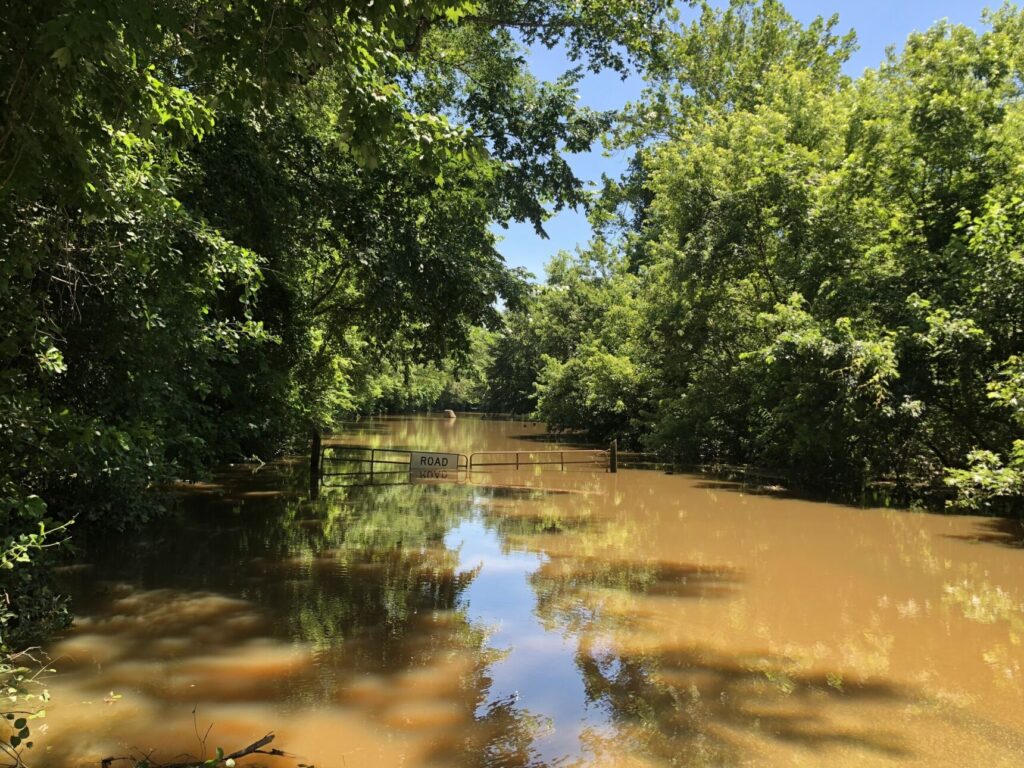
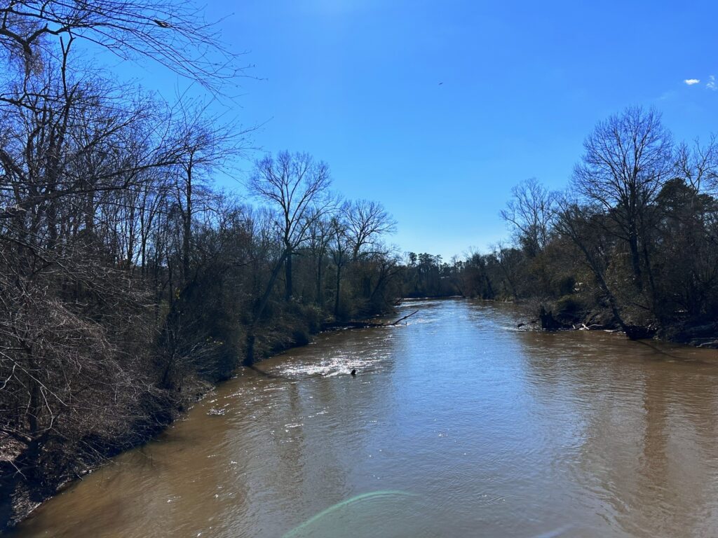
Flooding impacts from the Tar River in Princeville, NC
Understanding River Basins
A river basin encompasses the area of land drained by a river and its tributaries. Each basin serves as a natural watershed, starting with the rainwater and flow of a central river system that shapes the landscape and ecosystems as the water moves through. River basins influence many concepts of the surrounding area, including local agriculture, urban planning and infrastructure, drinking water, wildlife habitat and diversity and the local economy. Each river basin in North Carolina has its own movement of water from the headwaters to an outfall into the ocean, an estuary, or another river.
With the 17 river basins in North Carolina, each holds a unique ecological and topographical footprint in response to rainfall events that occurred upstream. Starting with rainfall, water accumulates into a basin that flows into subsequent bodies of water through a stream, river, tributary, groundwater, etc. As water accumulates and moves downstream, the river basin acts as a bathtub, collecting all contents and diverting where necessary.
With more severe climate-change caused weather events, an influx of water to a river basin will cascade into surrounding areas, causing floods.
The North Carolina Flood Resiliency Blueprint will serve as an online decision-support tool for policymakers, stakeholders and all North Carolinians with the knowledge required to make flood management decisions. The initiative was launched by the NC General Assembly and NC Department of Environmental Quality in collaboration with local and state agencies from across the state. In this process, having stakeholders present from various river basins is crucial to creating a tool that serves all communities and residents of the state.
As a starting point for proposed flood mitigation action, the Blueprint process will develop basin-wide action strategies for six target river basins: French Broad, Tar-Pamlico, Cape Fear, Neuse, Lumber and White Oak River Basins.
CTNC’s Western Conservation Manager, Aaron Flannery, highlights the importance of preserving land to enhance community resilience. “Protecting land in western North Carolina is crucial to the health of NC’s river basins that are fed from waters along the Parkway. Ensuring that the land along the Blue Ridge Parkway is preserved impacts everything that occurs downstream, including water quality, economic development, local and state parks, community resilience and the wildlife that calls the ecosystems of NC home.”
Serving as the third largest river basin in North Carolina, protecting the land along the Neuse River Basin is critically important to the cities within the basin by providing drinking water in nine dedicated reservoirs – Falls Lake, Lake Michie, Little River Reservoir, Lake Holt, Lake Orange, New Hillsborough Lake, Corporation Lake, Lake Ben Johnson and Lake Rogers. The basin also holds wetland forests that divert water from flooding nearby communities and captures runoff and rainfall to prevent impacts to downstream communities. For 12 years, CTNC partnered with the City of Raleigh to administer a watershed protection program, The Upper Neuse Clean Water Initiative, designed to raise funds to help land trusts protect land upstream of a rapidly growing region and critically important source of drinking water for the Triangle region.
Protecting these bodies of water is crucial to the flow of water from the mountains to the sea. With the tool created in the Flood Resiliency Blueprint, members of each river basin’s communities can expect to gain a deeper understanding of their floodplain, the history of flooding in that region and the best strategies to combat the impacts of flooding specific to that area.
Collaboration from all regions of the state is important to ensure that all communities are represented and heard when creating tools like the Flood Resiliency Blueprint. The decisions made upstream in the Western part of the state will impact communities downstream throughout NC. To address the increasing threat of climate-change caused events, like flooding, community and county boundaries will be crossed to foster collaboration in creating effective solutions. CTNC’s relationships with local government organizations, statewide conservation partners and landowners will be prioritized to ensure a holistic approach to flood mitigation strategies occurs in communities across every river basin in North Carolina.
The blueprint aims to reduce North Carolina’s annual losses to lives, property and livelihood because of extreme storms and flooding events, and their overall vulnerability. Another goal of this initiative is to decrease the weight of taxpayer dollars used to rebuild infrastructure damaged in said events. The strategic investments to flood resilience planning in specific areas of the state will benefit multiple departments, including water quality, the local economy, the public health system and outdoor recreation.
Funds allocated to the NC Department of Environmental Quality by the North Carolina General Assembly allowed this initiative to advance, evolving the project to the next step of involving stakeholders in developing the tool. The blueprint is a culmination of collaboration from local and state agencies, along with CTNC, combining shared resources and knowledge to be utilized on one shared platform for all. The primary objective is to empower decision-makers at each level with the tools and strategies required to mitigate flood risks effectively.
Nuisance flooding is a direct result of a changing climate, where change is needed now more than ever. Combatting the impacts of flooding is an issue CTNC is not new to. In Eastern NC, Princeville, located alongside the Tar River, was hit by Hurricane Matthew in 2016, leaving the town in disarray from flooding. The collaborative partnerships with Princeville after Hurricane Matthew showed that flood resiliency is attainable. The initiative of a statewide action to combat flooding drives CTNC’s goal of fostering community resilience through climate action.
In response to the flooding events in Edgecomb County, CTNC, in collaboration with NC State’s Coastal Dynamic Design Lab, created the Princeville Floodprint. The goal of this project was to mitigate the impacts of flooding and involve the local community in efforts to strategize and prepare for future flooding events. This project supported state agencies and local leaders to effectively engage in a community resilience framework.
With the North Carolina Flood Resiliency Blueprint, multiple communities will be offered support like the model created by the Princeville Community Floodprint. Replicating this process on a broader level will allow the project to evolve into a larger, statewide movement with similar seeds of success seen in Princeville.
As the next steps of the blueprint unfold, the State has identified six river basins to engage more deeply with community and elected leaders to better understand the scope and scale of flood resiliency planning and investments.
With a clear, unified framework in place, lives and communities will be better prepared and protected from nuisance flooding. North Carolina will serve as the groundwork for the first-of-its-kind flood resiliency program, that could aid other states across the country in preparing for the future of their respective communities.
Through the Mountain Revolving Loan Fund, CTNC allocates small grants to preserve critical areas of land protected and stewarded by our land trust partners.
Through the Mountain Revolving Loan Fund (MRLF), CTNC works with land trusts to conserve land in Western North Carolina. In addition to providing critical bridge loans to eligible land trusts, CTNC’s MRLF provides small grants to fill funding gaps that enable completion of projects that preserve the ecosystems and cultural sites along the Blue Ridge Mountains.
The CTNC Mountain Revolving Loan Fund has two significant benefits for our partners:
It provides crucial bridge financing with minimal interest to land trusts in Western North Carolina to purchase conservation land and easements. As loans are repaid, the money becomes available to re-lend.
A percentage of the balance of the loan fund is given out each year in grant awards. Grants of up to $25,000 are not required to be paid back. CTNC’s grants help cover transaction-related costs, land management, project administration, and long-term stewardship; often the most difficult project funding to raise.
This year, CTNC awarded grants to four land trusts totaling over $90,500. We’re proud to support the costs associated with ensuring that 516 acres of land will be protected in perpetuity. We look forward to more opportunities to work in partnership with key stakeholders to protect and steward this living legacy.
The land trusts that were awarded grant funds by CTNC during the current cycle include:
Blue Ridge Land Conservancy
Conserving Carolina
Highlands-Cashier Land Trust
Mainspring Conservation Trust
The eight properties that will be protected by our partner land trusts offer ecological, agricultural, recreational, and cultural-historic benefits to communities of Western NC.
Along with the conservation values of these properties, each contains crucial ecological and agriculture benefits to the local landscape and communities of Western NC.
CTNC’s support of statewide conservation initiatives is made possible through generous donations from CTNC supporters. Your generous support enables us to carry out our mission to foster community resilience in Western NC and throughout our amazing state.
CTNC and Bald Head Island Conservation Partners Collaborate to Build New Prioritization Tool
The beauty and unique ecology of Bald Head Island needs to be protected. The abundant nesting sea turtle population, vital maritime evergreen forest, and coastal ecosystems need specialized care to ensure they survive for generations. This summer, CTNC and partners on the island teamed up to develop a conservation prioritization tool that will inform how to deploy future work.
The Bald Head Island Conservation Prioritization Tool, developed by Hanna Bliska, a CTNC 2023 Stanback Summer Fellow, is a model that identifies individual properties on the island with the highest conservation value. This will enable Smith Island Land Trust and its partners to focus efforts and limited resources on properties with the most significant conservation impact.
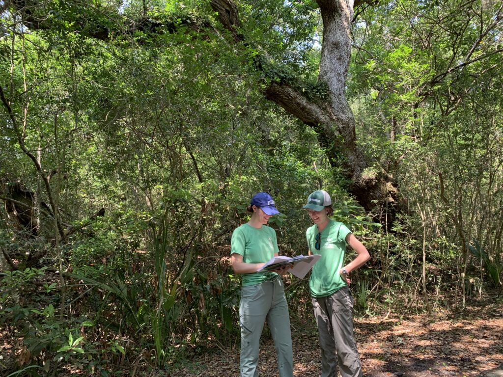
CTNC Summer Fellows Hanna Bliska (left) and Emma Childs (right) visited Bald Head Island in June to ground-truth the results of the prioritization model.
To make the tool come to life, Hannah collaborated with CTNC Bald Head Island conservation partners and CTNC staff to build the prioritization tool in ArcGIS. This tool is inspired by CTNC’s Blue Ridge Parkway prioritization model that we use to streamline efforts and strategic goals. The plan focuses on protecting undeveloped land on Bald Head Island. The model has incorporated a variety of ecological data, including data on coastal and terrestrial resilience to climate change developed by The Nature Conservancy.
Undeveloped acreage is critical to both natural and human success on the island. Beyond protecting vital forested and coastal areas, these conserved acres become buffers to soften the impacts of climate change on Bald Head Island. The maps inform SILT’s communications with landowners and educate islanders about conservation opportunities. This will, in turn, ensure a resilient future for the communities that call Bald Head Island home.
The Bald Head Island Conservation Prioritization Tool further demonstrates CTNC’s commitment to creating sustainable programs in collaboration with partners to utilize data-driven approaches to conservation. SILT will maintain the tool to update it as more conservation progress is made on the island. Through partnerships like this, CTNC is helping North Carolina build resilience in the face of climate change.
Thank you to the development team – Hanna Bliska, Rusty Painter, Mary Alice Holley, and Emma Childs. Funding for the project was provided by SILT and Hannah’s time with CTNC was made possible by the Stanback Fellowship Program at the Nicholas School of the Environment at Duke University.
State Legislators come through with a conservation win
Help us send a big thank you to North Carolina’s legislators and governor for allocating over $100 million to the conservation trust funds and other conservation projects in the 2023 State Budget. This funding will benefit people and our land for generations to come.
Land for Tomorrow is a statewide coalition of community leaders, conservation, and wildlife organizations, and parks and recreation advocates with a common goal: increasing land and water conservation in North Carolina. The state’s three conservation trust funds, the North Carolina Land and Water Trust Fund (NCLWF), the Parks and Recreation Trust Fund (PARTF), and the Agricultural Development and Farmland Preservation Trust Fund (ADFPTF) are essential tools that allow state agencies and nonprofit partners to protect North Carolina’s valuable natural resources.
The Coalition recognizes these conservation heroes who went the extra mile to protect our state’s most loved places. The Land for Tomorrow Coalition applauds the following legislators:
If you have time, please send a thank you note to your local legislators for protecting our state’s natural resources through the budget this year. Their perseverance in protecting this funding should be commended.
CTNC is dedicated to stewarding smart conservation policies for the benefit of North Carolina’s resilient communities. Join us in supporting this important mission.
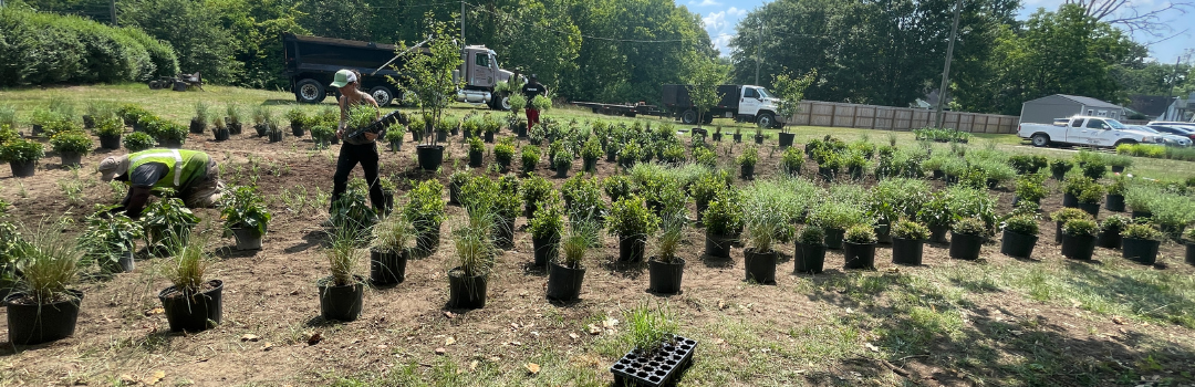
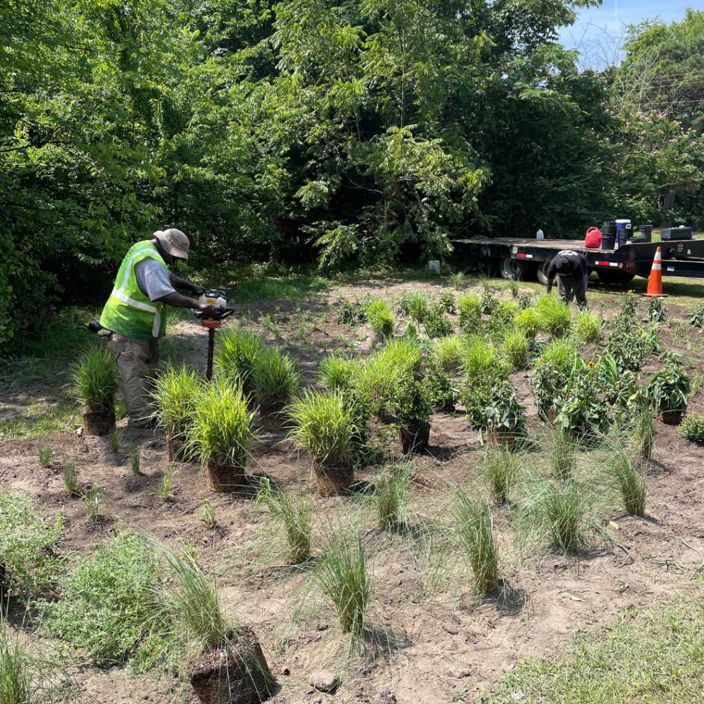
The town of Princeville knows that well, as do many climate-impacted towns in North Carolina. A spot of historic and devastating flooding as well as every-day challenges resulting from nuisance flooding, this town invested in building natural stormwater capture devices while enhancing once-vacant land throughout the community.
In the summer of 2023, CTNC spearheaded a project to install green infrastructure with wetland enhancement projects on vacant, town-owned parcels along the Tar River. These are now sites where stormwater can naturally flow and reduce nuisance flooding that causes inconveniences to residents, roads, and neighborhoods in populated areas. The project created 6,000 square feet of stormwater retention strategies, including bioretention cells and rain gardens designed to hold 27,740 gallons of water per rain event.
Princeville elected leaders worked with residents and partners to identify three locations throughout town where standing water was already creating safety hazards following large rain events. By turning these sites into managed wetland areas with trees, shrubs, and pollinator plants, each site can now absorb stormwater and address standing water issues. This is all while beautifying each plot with seasonal colorful blooms and leaves, supporting native wildlife, including birds and other pollinators.
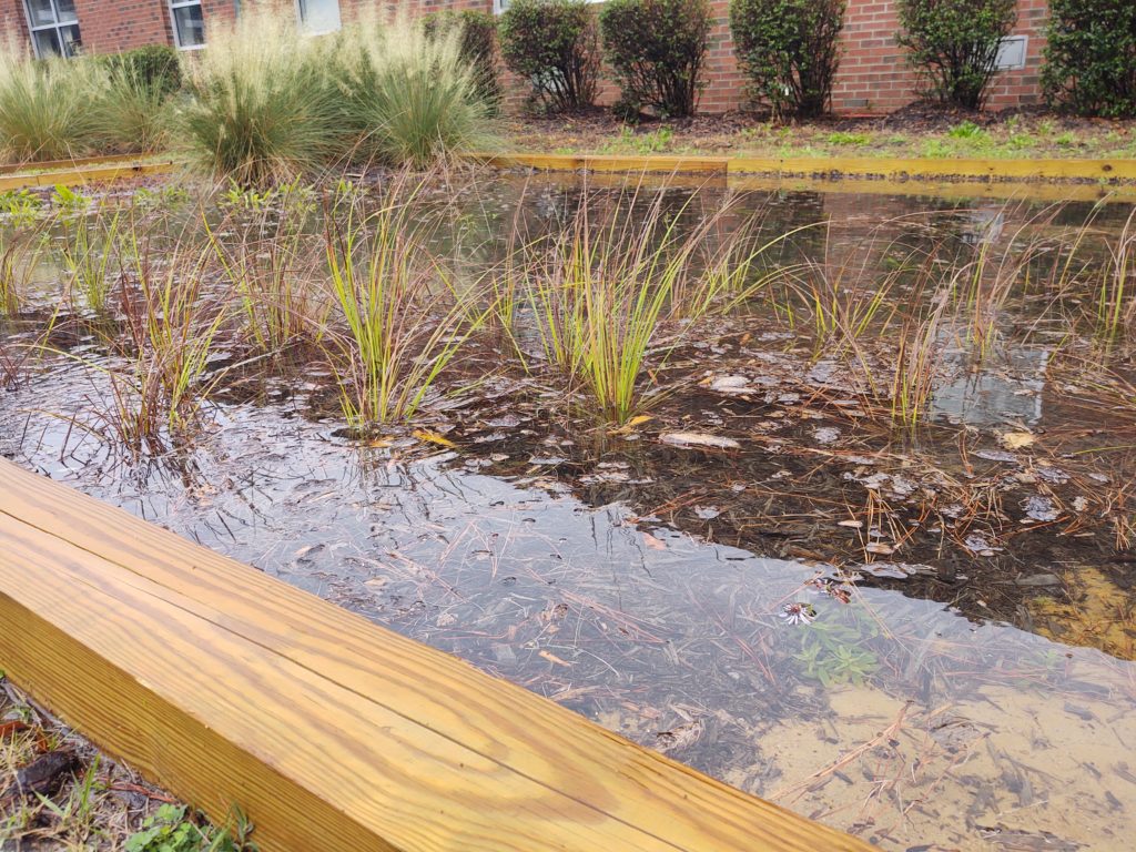
GARDENS ARE READY TO BLOOM
Site 1 is located at Town Hall and Freedom Hill to help add stormwater runoff at a high-traffic intersection of Princeville. The site includes NC native pollinator plants including Soft Rush, Walker’s Low Catmint, and Black-eyed Susan.
Site 2 is located at the corner of Church and Walston Streets, and Site 3 is located at the corner of Beasley and Walston Streets. These locations were selected due to their proximity to the elementary school rain garden installations completed in 2020.
The project is continuing with an important science component. The Town of Princeville seeks to incorporate community education into every conservation project that takes place. In the case of the stormwater infrastructure improvements, CTNC received funding from TELUS to purchase sensors that track the water absorption rate of the wetland areas. These sensors are offered by Temboo, a technology company that utilizes data to engage communities in understanding their environmental impact locally. The sensors will be installed this summer and will collect data that will be shared with town leaders, educators, students and families to showcase the importance of conservation as a natural solution to flooding and other climate-related issues being experienced by Princeville and surrounding communities.
RAIN GARDENS & WETLAND ENHANCEMENTS OFFER A CLIMATE SOLUTION
Communities across North Carolina are experiencing greater occurrences of precipitation and rain events that cause minor and major flooding. Conservation solutions, like installing rain gardens and other stormwater management techniques, are a great way to manage flood water while benefiting communities and residents. These types of installations are beautiful, offer a benefit to wildlife like birds and pollinators, effectively manage stormwater, naturally filter contaminants from water flow before it reaches a river or stream, and are low maintenance options for long-term care. CTNC supports natural solutions like stormwater infrastructure to benefit communities seeking to build resilience to flood challenges exacerbated by our changing climate.
The stormwater designs and plant selections were created by NC State Coastal Dynamics Design Lab based on recommendations from the Princeville Community Floodprint. It was informed by input from Princeville residents and approved by the Town of Princeville Board of Commissioners. The project will be installed by M&M Landscaping – a local contracting partner participating in the conservation projects being funded through CTNC.
Funding for this project was generously provided by the Commission for Environmental Cooperation EJ4Climate grant.
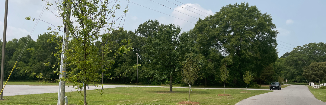
Flowering Trees Put Down Roots for Climate Resilience in Princeville
The streets of Princeville are now lined with flowering native trees, thanks to your support and federal grant funding. This beautification project puts down roots for future flood resilience and carbon sequestration.
The project, completed in the spring of 2023, planted 50 native trees along streets within Princeville’s historic core. Trees were selected through a community-input process where residents were invited to learn about the ecological benefits of street trees and vote for their favorite trees. The trees selected were eastern serviceberry, red maple, and musclewoods.
The trees were chosen for their ability to:
Provide beautification to Main Street and surrounding neighborhoods,
Showcasing seasonal colorful blooms and leaves,
Support native wildlife, including birds and other pollinators,
Absorb stormwater from flood-prone areas and carbon from the atmosphere, and
Reduce the temperature of sidewalks for pedestrians.
Conservation can provide solutions for communities seeking to build resilience to projected and future climate change impacts – including flood, fire, drought, and food insecurity. Tree planting projects – also known as urban greening – that increase the number of small and medium trees located within a town footprint are known to provide multiple climate and community benefits, including:
Combat air and noise pollution
Soak up rainwater that may otherwise create flooding
Create a habitat for local wildlife
Offset carbon emissions in the local area
Increase resident satisfaction with physical and mental health benefits
In partnership with the Town of Princeville, the tree plan was designed by NC State Coastal Dynamics Design Lab based on recommendations from the Princeville Community Floodprint. It was informed by input from a Princeville resident online survey and approved by the Town of Princeville Board of Commissioners. The trees were installed by M&M Landscaping – a local contracting partner participating in the conservation projects being funded through CTNC.
The partnership with the Town of Princeville is ongoing, and the need to address stormwater and flooding challenges is great. With additional funding and coordination with the local community, we plan to expand our footprint and include more tree plantings in future years. Be part of helping build a more resilient North Carolina. Explore your donation opportunities now.
North Carolina has seen an unprecedented investment in building resilience against the effects of our changing climate. Hundreds of millions of dollars have flowed to statewide flood resiliency modeling efforts, coastal community planning, and more. Billions of additional dollars from federal sources have also been earmarked for climate resilience.
Yet, there is a crucial next step to ensure these projects come to life: activating local community capacity. Communities across North Carolina must be able to take advantage of the information, support, and financial resources made available. CTNC has heard from nonprofit organizations and local leaders that too many communities seem to lack that needed capacity.
STUDY
To begin to address this vulnerability, CTNC commissioned a study in fall 2022 to gather information and input on what role service programs might play in building community capacity around climate resilience. The resulting Resilience Service Network: Case for Support affirms that existing and new service programs are well-positioned to play a vital role in assisting communities seeking to leverage the climate resilience investments being made. Though, as the study also shows, service in North Carolina must be greatly expanded and substantively changed to realize this potential.
Communities across North Carolina are ready to address the threat of climate change, but they’re hindered by a lack of capacity to mobilize an effective response. The existing service capacity needs to grow, and the activities involved will require greater diversity to respond effectively to community needs. Stakeholders and programs recognized host costs, administrative burdens, member benefits, and high match and project costs as major barriers to implementing a comprehensive service network in the state. The team also found that the state currently offers a patchwork of relevant support that is not commensurate with the scale of the needs of North Carolina’s communities.
Fortunately, North Carolina is slated to receive significant investment in flood prevention, critical infrastructure and transportation, and other projects designed to increase resilience. These investments will provide opportunities to meet the funding levels required to realize this effort at scale. Building on existing planning efforts and financial support, the team identified flood response as an established mechanism to direct service to communities in need.
RECOMMENDATIONS
Based on the findings, this report identifies a set of summary recommendations that reflect the most common themes and opportunities for a statewide resilience service initiative.
Implementation
What framing or program design steps should be taken to build a stronger service effort in North Carolina.
Start With Flood Response
Focus on Resilience
Localize to Galvanize
Reinforce What’s Working
Strategically Fill Gaps
Coordination
What steps might be taken to ensure the effort is well coordinated so it can deliver the greatest impact for the state.
Adapt to Thrive
Build a Network, not a Program.
Emphasize Catalytic Over Functional Outcomes
Follow the Money / Unlock the Potential
Resilience Service Network Concept
What operational and funding design will be required to achieve success at a statewide scale.
Operational Design
Funding
While this study is a seed of an idea, we see great potential in service programs to help alleviate community capacity concerns, build a resilience-oriented workforce, and maximize additional investments in the state’s resilience. North Carolina is primed to lead the nation on creative and innovative solutions for climate action.
To connect with us on the Resilience Service Network, inquire about joining as a partner organization or host site, or learn more about how service programs can work in your community, email americorps@ctnc.org.
This website uses cookies to improve your experience. We'll assume you're ok with this, but you can opt-out if you wish. Cookie settingsACCEPT
Privacy & Cookies Policy
Privacy Overview
This website uses cookies to improve your experience while you navigate through the website. Out of these cookies, the cookies that are categorized as necessary are stored on your browser as they are as essential for the working of basic functionalities of the website. We also use third-party cookies that help us analyze and understand how you use this website. These cookies will be stored in your browser only with your consent. You also have the option to opt-out of these cookies. But opting out of some of these cookies may have an effect on your browsing experience.
Necessary cookies are absolutely essential for the website to function properly. This category only includes cookies that ensures basic functionalities and security features of the website. These cookies do not store any personal information.